Land Surveying
Hire Aero Land Surveyors For Precise & Accurate Land Surveying Results In Yavapai County, AZ!
Why Is Commercial & Residential Land Surveying Important In The Modern Age?
It is practically impossible to measure and map out the land you’ve purchased for residential & commercial purposes. In such situations, you should hire a licensed surveyor company for residential & commercial land surveying services.
Aero Land Surveyors is a leading research and development company founded in 2016. We are known for leveraging commercial off-the-shelf land mapping technology & combining it with proprietary data collection techniques to get an accurate land surveying result, be it residential or commercial land surveying.
At Aero Land Surveyors, land surveying is conducted by an experienced team of licensed surveyors for property surveys or equal land subdivisions. We incorporate modern-age data collection & property surveying techniques with an experienced team of construction surveyors.

C) Boundary Survey
As the name suggests, a boundary survey is a land surveying technique for locating boundary lines and property line markers on a land piece.
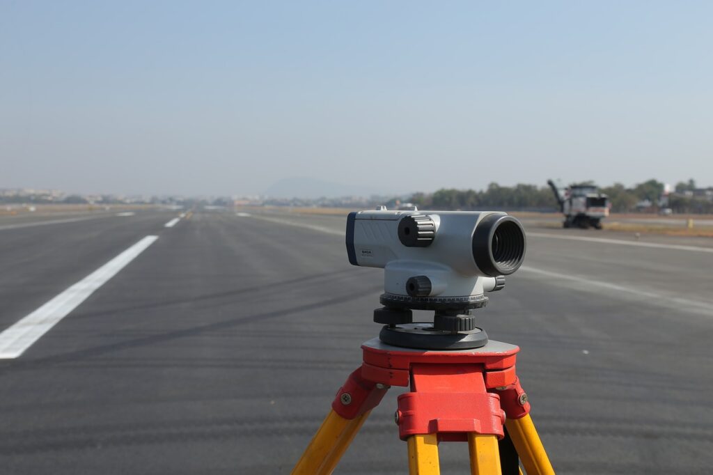
At Aero Land Surveyors, our licensed surveyors incorporate advanced mapping techniques like Electronic Distance Measurement (EDM), Global Positioning System (GPS) & Total Station Theodolite (TST) to measure accurate land markers, property lines, and contour lines.
Types Of Land Surveying Services At Aero Land Surveyors
At Aero Land Surveyors, we offer various surveying services backed with the latest data collection, scientific techniques, and advanced GPS mapping support. Our land surveying use cases broadly fall under the below-mentioned categories:
A) Topographical Survey
A topographical survey is the standard land surveying service for setting up environmental restoration projects in Yavapai County, AZ. Primarily, this survey includes measurements of the steep & vertically inclined elevations of the land’s surface.
B) Construction Survey
A construction survey is a type of land surveying in which construction surveyors map the buildings, roads, and walls on commercial land. At Aero Land Surveyors, our construction surveyors draw reference points and property line markers to visualize the new constructions in Yavapai County, AZ.
Modern Techniques Of Commercial & Residential Land Surveying
Using modern land surveying methodologies for commercial land surveying and residential land surveying have the following benefits:
- a) Airborne Imaging Facility: With modern land surveying methods, it is possible to obtain airborne photographs & combine them with ground-based measurements to shorten fieldwork times.
- b) 3D Modeling Facility: At Aero Land Surveyors, we use 3D models to prevent misinterpretations of existing property conditions.
- c) Accurate GPS: High-accuracy GPS technology on the ground ensures high-quality data.
d) On-Time Survey: Modern land surveying techniques help collect data in just a few hours.
Why Should You Hire Aero Land Surveyors For Land Surveying?
At Aero Land Surveyors, we have a dedicated support staff to deliver pleasant experiences to our clients. You can count on us for top-notch land measuring & mapping services because:
1) Highly Competent: We are competent & deliver top-notch results at affordable rates.
2) National Survey: Unlike most land construction surveyors, our services are nationwide.
3) Accurate & On-Time: We are known for completing projects on time, backed by monetary commitments.
If you need top-notch land surveying services, call Aero Land Surveyors to help you get accurate land measuring & mapping services at affordable rates in Yavapai County, AZ.
Get Accurate Land Surveying Results
Contact Us Now!
Address
1650 Sycamore Ave, Suite 14, Bohemia, New York 11716 USA