Land Surveyors in Port St. Lucie, FL

Defining Property Boundaries in St. Lucie County

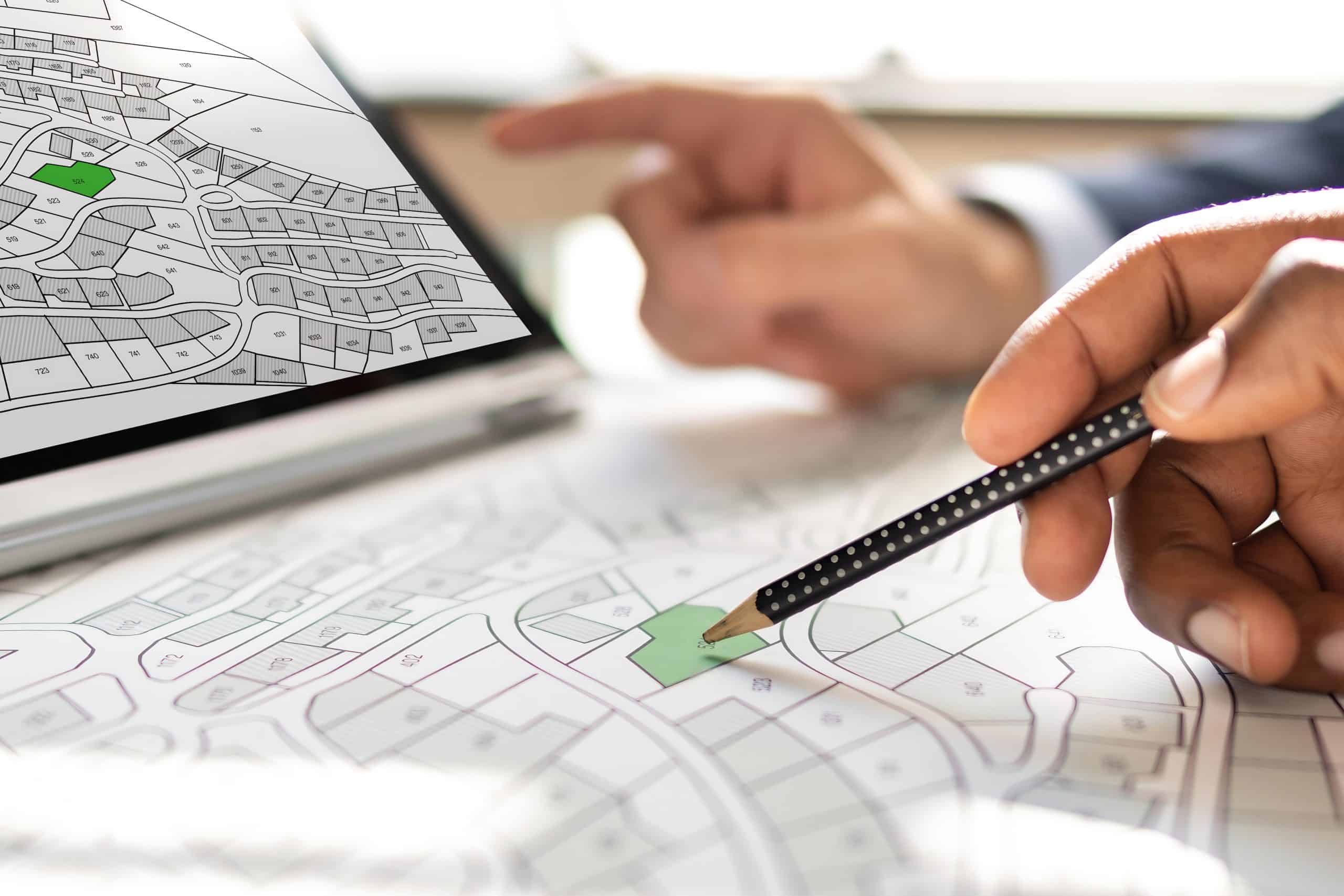
Are you sure about your property lines? Understanding your exact boundaries is fundamental before starting any construction, resolving neighbor disputes, or simply knowing the extent of your land in Port St. Lucie. Engaging professional land surveyors provides the clarity needed for property transactions and development projects.

A person holds a pencil over a detailed map while another hand points at a laptop displaying a similar map. The scene suggests a focus on urban planning or real estate development, possibly guided by Land Surveyors in Martin County, with marked plots and sections highlighted in light green.

Hear from Our Customers

A person in a gray blazer is sitting at a desk, working on architectural blueprints with a pencil. A laptop is partially visible next to them while several detailed floor plans of Land Surveyors Martin County are spread out on the desk.

Benefits of Professional Land Surveyors in Port St. Lucie

Need Land Surveying in Port St. Lucie, FL
  • Clearly establish your property’s legal boundaries, preventing potential disagreements with neighbors about land ownership or encroachments.
  • Obtain the necessary documentation for building permits, additions, fences, or landscaping projects within St. Lucie County regulations.
  • Identify any easements, rights-of-way, or zoning restrictions that might affect how you can use your property in Port St. Lucie.
  • Gain confidence in real estate transactions by verifying the exact acreage and physical limits of the land you are buying or selling.
  • Choosing Your Land Surveyors in Port St. Lucie

    Our Approach to Land Surveying Services

    At Aero Land Surveyors, we focus on carrying out precise land surveying results. We recognize that every property has distinct characteristics, and we approach each project with careful attention. Our process begins with understanding your specific requirements, whether it’s for a simple boundary stakeout or a more complex topographical map.

    We utilize modern surveying equipment, including Global Positioning System (GPS) receivers and robotic total stations, combined with established methods to provide the smoothest service possible. This combination allows us to gather accurate field data efficiently. We research deeds, plats, and historical records relevant to your property in St. Lucie County to supplement our fieldwork, creating a full picture of your land’s history and legal description. Aero Land Surveyors is committed to clear communication throughout the surveying process.

    A construction worker in a white hard hat and yellow safety vest holds a walkie-talkie beside surveying equipment at a busy site. Land Surveyors Martin County might be involved, with another tripod visible in the background.

    The Port St. Lucie Land Surveyors Process

    Our Land Surveyors in Port St. Lucie, FL: 3 Steps
  • Initial Consultation & Research: We discuss your needs, gather property information, research existing records (deeds, maps), and provide a project scope.
  • Fieldwork: Our team visits the property to take precise measurements using tools like GPS and total stations, locating existing markers and establishing boundary lines.
  • Map Preparation & Report: We process the field data, draft a detailed survey map or plat, prepare any necessary reports, and present the findings to you.
  • An aerial view of a lush green landscape with fields and a village in the distance, marked by red location markers and a dotted line outlining farmland. This serene scene could be part of Land Surveyors Martin County, with rolling hills and a partly cloudy sky in the background.

    Ready to get started?

    Explore More Services

    About Aero Land Surveyors

    Get a Free Consultation

    Finalize Your Property Plans with Confidence

    Select Aero Land Surveyors for Your Surveying Needs in St. Lucie County

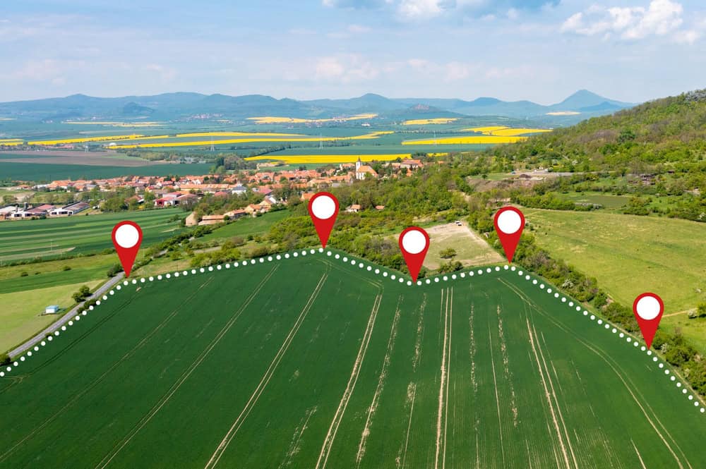
    An accurate property survey is foundational for informed decisions regarding your land in Port St. Lucie. When planning construction, settling a boundary question, or completing a real estate transaction, knowing the precise details of your property is invaluable. Using advanced technology like high-definition scanning alongside traditional measurement techniques allows for detailed data collection. We process this data using specialized mapping software (e.g., CAD programs) to create clear, legally defensible survey documents customized to FL requirements. Let Aero Land Surveyors provide the detailed surveying services you require.

    A person in safety gear, including a hard hat and reflective vest, holds a tablet displaying a construction plan while standing in a grassy field under the sunlight, embodying the expertise of land surveyors in Okeechobee County.
    A land surveyor measures and maps land features, determines property boundaries based on legal descriptions and field evidence, and creates official plats or maps used for legal and construction purposes.
    Deeds describe boundaries but don’t physically mark them. A property survey translates the deed’s description into physical points on the ground, resolving ambiguities and confirming the actual lines.
    Consider hiring land surveyors before buying property, building fences or additions, subdividing land, or if you suspect an encroachment or boundary dispute with a neighbor in Port St. Lucie.
    Costs vary based on property size, terrain complexity, record availability, and the type of survey needed. Simple boundary surveys might range from $500 to $2000+, but Aero Land Surveyors provides specific quotes after initial assessment.
    We employ a range of tools, including GPS receivers for precise positioning, total stations for measuring angles and distances, data collectors, and sometimes drones or scanners for topographical mapping.
    The timeline depends on factors like property size, terrain, record research, and current workload. A residential survey might take one to several weeks from start to delivery of the final map.