Summary:
How We Start Your Professional Land Survey Project
Before anyone sets foot on your property, the real work begins at our desk. We start by reviewing county registry records to locate deeds for your property and surrounding properties, then conduct research to find documentation from previous land surveys, municipal offices, state offices, and historical societies.
This research phase matters more than most people realize. We’re building a complete picture of your property’s legal history. We’re looking for original survey markers, checking for easements, and understanding how your boundaries relate to neighboring properties.
The preparation work can take anywhere from a few hours to several days, depending on your property’s complexity and age. Properties with clear, recent surveys move faster. Older properties or those with complicated ownership histories require more detective work.
What Records and Documents We Research Before Field Work
We’re not just winging it when we show up with our equipment. We’ve already spent considerable time gathering the legal foundation for your survey. We delve deep into land titles and other records, gathering all essential information to ensure the legal description of a property is accurate.
The document research includes your current deed, which contains the legal description of your property boundaries. But we don’t stop there. We also pull deeds for neighboring properties to understand how boundary lines connect and where potential conflicts might exist.
Previous survey records are gold mines of information. If your property was surveyed before, those documents show where markers were placed and what conditions existed at the time. Florida’s survey history goes back to around 1824, with original survey notes and plats preserved, and Certified Corner Records collected since 1977.
County planning and zoning records reveal important restrictions that affect your property. These might include setback requirements, easements for utilities, or environmental restrictions. Municipal records can show right-of-way information, especially important if your property borders public roads.
We also check with utility companies to understand where underground lines, water mains, and sewer systems run through or near your property. This prevents accidents during the survey and gives you a complete picture of what exists on your land.
Historical societies and local archives sometimes hold crucial information about older properties, especially in areas where development patterns have changed over time. This research phase ensures we have the complete story before we begin field work.
Modern Survey Technology and Equipment Setup
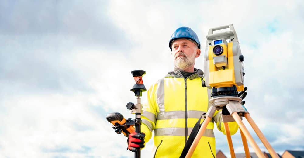
Today’s professional land surveyors use technology that would seem like science fiction to surveyors from even a decade ago. With GPS and robotic total stations, we can pinpoint exact locations and significant features with high accuracy. Rapid advancements in GPS, drone imaging, 3D laser scanning, and AI have transformed land surveying, creating faster, more precise, and cost-effective boundary surveys across Florida.
Our equipment setup process is methodical and precise. We establish a base station using GPS technology that connects to a network of reference points maintained by government agencies. This creates a coordinate system that’s accurate to within inches or even fractions of inches.
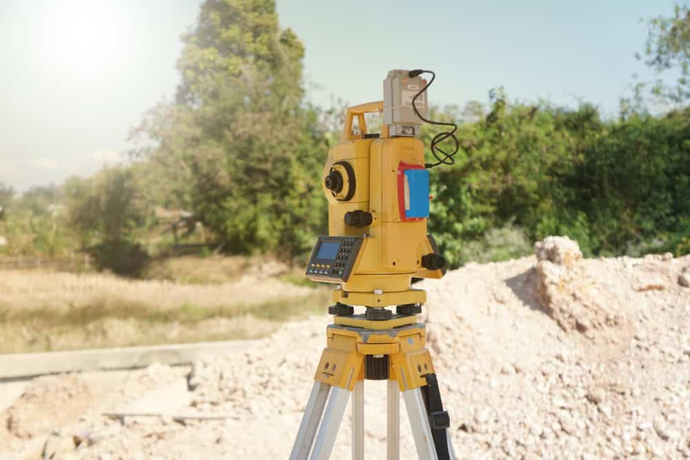
Robotic total stations are the workhorses of modern surveying. These instruments can measure distances and angles automatically, guided by us using a handheld controller. The technology eliminates much of the human error that could occur with older surveying methods.
Drone technology has become increasingly important, capturing topographic data five times faster than land-based methods without requiring additional manpower. For larger properties or areas with difficult terrain, drones provide aerial perspectives that help us understand the complete picture.
3D laser scanning technology creates incredibly detailed digital models of your property. Many surveying drones are equipped with LiDAR to see through vegetation and ground cover, generating densified point clouds with color and geospatial information for highly accurate area, volume, and distance measurements.
The combination of these technologies means your survey will be more accurate and completed faster than ever before. But the technology is only as good as the professional operating it, which is why working with licensed, experienced surveyors makes such a difference.
The Field Work Process and What Happens on Your Property
The most important phase happens when we hit the ground for the actual survey, locating and marking each corner of the property. This is where all that research and preparation pays off. We arrive with a clear plan based on the legal documents, but we still need to physically locate boundary markers and verify the actual conditions on your property.
The field work typically takes one to three days for residential properties, depending on size and complexity. Commercial properties or larger tracts may require a week or more. Weather conditions can affect the timeline, especially in Florida where afternoon thunderstorms are common.
You don’t need to be present during the field work, but many property owners find it interesting to watch and ask questions. We’re usually happy to explain what we’re doing and point out important features we discover.
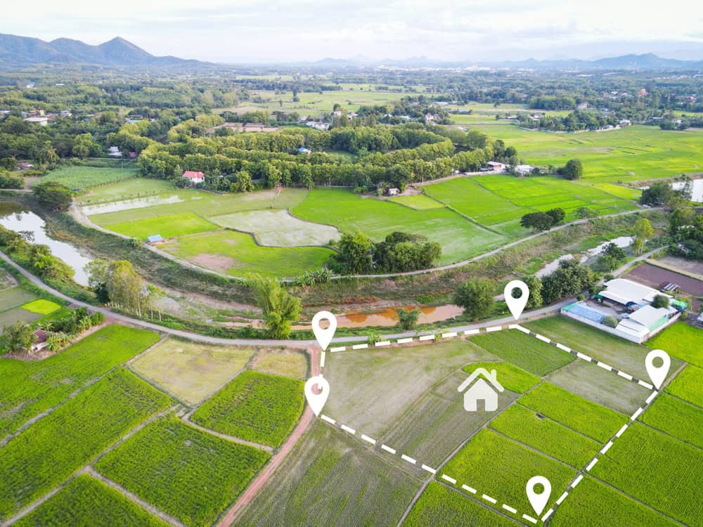
How We Locate and Mark Property Boundaries
Finding your actual property corners requires a combination of high-tech equipment and old-fashioned detective work. We use specialized equipment to compare historical data with existing markers and come up with accurately defined property lines.
The process starts with locating existing survey monuments – metal pins, concrete markers, or other permanent markers placed during previous surveys. These might be buried under years of soil and vegetation, requiring metal detectors and careful excavation to uncover.
Using state-of-the-art measuring equipment, we take precise measurements of distances and angles to ensure every piece of land and structure is accurately accounted for. We measure from known reference points to establish the exact location of property corners, even when original markers are missing or destroyed.
When original markers can’t be found, we use the legal description from your deed to calculate where corners should be located. We then place new permanent markers – typically metal pins driven several feet into the ground – to mark these corners for future reference.
We also note the condition and location of any existing fences, buildings, driveways, or other improvements. We confirm whether improvements on the property conform with applicable state or federal laws and other restrictions, and if any violations are discovered, this information is included in our notes.
Elevation measurements are taken at various points across your property, creating a topographic picture that shows slopes, drainage patterns, and flood zones. This information is crucial for construction planning and insurance purposes, especially in Florida where flood considerations are important.
We also identify and map any easements that cross your property – areas where utility companies, neighbors, or government entities have legal rights to access or use portions of your land.
Survey Documentation and What You'll Receive
After completing field work, we compile all information and create the final land survey and boundary survey drawing. This isn’t just a simple sketch – it’s a legal document that could be used in court if boundary disputes arise.
Your survey plat shows your property boundaries as precise lines with measurements between each corner. All structures on your property are mapped and dimensioned, showing exactly how close they are to property lines. This information is crucial for understanding setback requirements and planning future improvements.
Professional land surveys provide basic information including the address, legal description, flood zone status, any encroachments from neighboring properties, our notes, certified owner indication, and our signature and seal.
The legal description included with your survey is often more precise than what appears on your deed. This description uses specific measurements and references to create an exact written definition of your property boundaries that can be used for legal purposes.
Our surveys include field notes showing site boundaries and easements, legal description, and metes and bounds description, with digital CAD data and PDF file formats submitted electronically.
Any easements affecting your property are clearly marked on the survey drawing. These might include utility access easements, drainage easements, or beach access rights, and since you’re responsible for keeping easements open to access, you need to know where and what they are.
Our notes section contains important observations that don’t appear on the drawing itself. This might include the condition of boundary markers, potential encroachments, or recommendations for resolving boundary questions.
We provide both paper copies and digital files of your survey. The digital versions are useful for architects, contractors, or engineers who might work on your property in the future.
Getting the Most Value From Your Professional Land Survey
A professional land survey is an investment in understanding exactly what you own and protecting yourself from future problems. A professional land survey allows you to confirm what you’re buying before you buy it, and in Florida, it’s the buyer’s responsibility to obtain a land survey to stay confident you’re getting what you’ve paid for and avoid unpleasant surprises.
The process takes time and costs money, but the alternative – discovering boundary problems after you’ve already committed to a property or started construction – costs much more. Professional surveyors provide the expertise and technology to give you accurate, legally defensible information about your property.
When you’re ready to move forward with your land survey, choose a company that combines modern technology with local expertise. At Aero Land Surveyors, we bring advanced GPS and 3D laser scanning technology to every project, backed by licensed professionals who understand Florida’s unique surveying requirements and local regulations.