Summary:
Why Golf Courses Need Specialized Land Surveying
Golf courses in Florida face unique challenges due to the state’s distinct climate, including hot and humid summers, unpredictable tropical storms, and mild winters. These conditions create specific surveying needs that go far beyond basic property mapping.
Research shows golfers most prioritize firm fairways and fast greens when evaluating courses, with putting green perception including three factors: Firm, Slope, and Speed. Achieving these standards requires precise topographic data that only professional surveying can provide.
Your course isn’t just a piece of property—it’s a complex ecosystem where every elevation change, drainage pattern, and boundary line affects playability and maintenance costs.
Topographic Surveys for Drainage and Irrigation Planning
Florida has strict environmental regulations with watering restrictions common due to the state’s vulnerability to drought, requiring golf courses to navigate these regulations while maintaining turf health through sophisticated irrigation systems. This makes accurate topographic data essential for efficient water management.
Topographical surveys provide detailed understanding of land features, contours, and elevations, essential when planning property improvements or construction projects, helping identify the best areas for building, landscaping, and installing utilities. For golf courses, this translates directly to smarter irrigation placement and more effective drainage systems.
Modern drone technology allows golf course data to be gathered rapidly, with the average 18-hole course going from signed contract to quality controlled deliverables in as little as 2 weeks, with unique software tools opening possibilities for project management. This speed means you can address drainage issues quickly, before they become expensive problems.
Florida’s climate is characterized by intense rainfalls, prolonged dry spells and high evaporation rates, making adaptive irrigation technologies necessary, with artificial intelligence now able to analyze historical weather patterns, soil data, and course usage to create hyper-personalized watering schedules. The foundation for these smart systems starts with accurate topographic surveying that maps every slope and elevation change across your course.
Consider how water moves across your property during Florida’s intense summer storms. Without proper topographic data, you’re essentially guessing where drainage problems might occur. Professional surveying eliminates that guesswork by providing precise elevation measurements that show exactly how water will flow, where it might pool, and where you need drainage solutions.
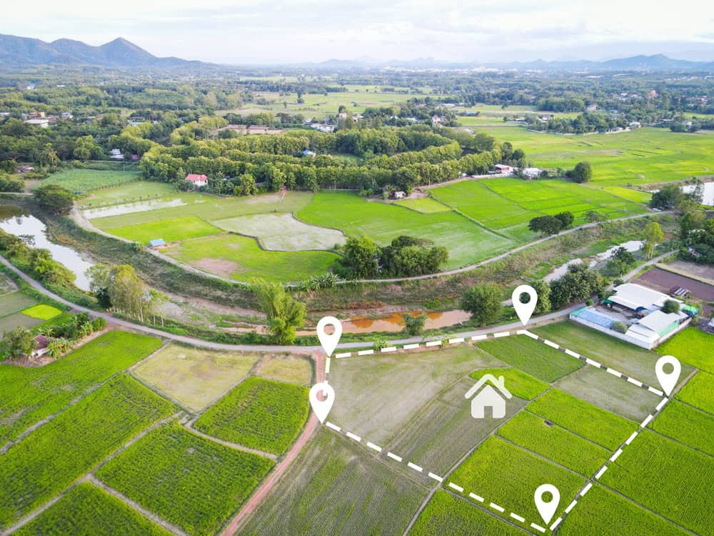
Boundary Surveys for Property Line Protection
Property boundaries are a critical aspect of any transaction, but uncertainties about boundary lines, encroachments, or easements can lead to costly disputes, delays, or legal complications. For golf courses, these issues can be particularly complex due to the large property areas and multiple adjacent landowners.
We play a critical role in defining and confirming legal boundaries by measuring and comparing physical features against descriptions in deeds, using specialized tools such as GPS and laser scanning to precisely measure land and create detailed maps that identify any encroachments and record easements. This level of precision is crucial when your course boundaries might include residential developments, municipal property, or environmentally sensitive areas.
South Florida, comprising Miami-Dade, Broward, and Palm Beach counties, has unique geographic and environmental challenges, known for its coastal areas, wetlands, high water tables, and hurricane risks. These factors make boundary surveying more complex but also more critical for protecting your investment.
Boundary disputes can shut down sections of your course, create expensive legal battles, and damage relationships with neighboring communities. Professional boundary surveying establishes clear, legally defensible property lines that prevent these problems before they start. This is especially important when you’re planning course improvements, installing new irrigation systems, or dealing with maintenance access routes that might cross property lines.
South Florida’s proximity to the ocean and abundance of wetlands mean many properties are subject to additional environmental regulations, with properties near wetlands requiring wetland delineation surveys to determine boundaries and ensure compliance with state and federal regulations. Your boundary survey needs to account for these environmental factors, not just traditional property lines.
The investment in professional boundary surveying pays for itself by preventing costly disputes and ensuring you can proceed with confidence on maintenance and improvement projects. You’ll have clear documentation of exactly where your property begins and ends, what easements exist, and how environmental regulations might affect your operations.
How Professional Surveying Supports Course Maintenance
Maintaining a municipal golf course in Florida requires diligent effort, creativity, and strategic planning to overcome unique challenges posed by tight budgets, diverse player bases, high traffic, weather extremes, and sustainability concerns. Professional surveying provides the data foundation that makes this complex management possible.
Regular aeration and verticutting are crucial for alleviating soil compaction and promoting root growth, with Florida’s golf courses needing more frequent aeration due to heavy rainfall and foot traffic, requiring strategic planning throughout the year. Topographic surveys help you understand soil conditions and drainage patterns that affect when and where these maintenance activities will be most effective.
Your maintenance decisions shouldn’t be based on guesswork. Professional surveying gives you the precise data needed to plan maintenance activities that actually improve course conditions rather than just addressing surface symptoms.

Maintenance Planning With Accurate Land Data
Golf course maintenance is more complicated than mowing a lawn and turning on sprinklers, involving maintenance activities to keep course resources in good working condition, including repairing assets, mowing and chemically treating turf, and improving playing conditions. Every decision you make should be informed by accurate land data.
High traffic on golf courses, especially in popular destinations like Florida, can lead to significant wear and tear, with frequent foot traffic and cart use leading to soil compaction that negatively affects root growth and turf health, requiring regular aeration to alleviate compaction. Topographic surveys help identify areas most susceptible to these problems based on natural drainage patterns and elevation changes.
Golf course microclimates and unique ecosystems demand different management programs, with some Florida courses built on old tomato fields or citrus groves having wall-to-wall nematodes, while other courses might have problems isolated to specific greens or tee boxes. Professional surveying helps map these variations so you can develop targeted maintenance strategies.
Think about how you currently plan aeration, overseeding, or drainage improvements. Are you working with accurate elevation data, or making decisions based on visual observation? Professional surveying provides precise measurements that show you exactly where water collects, where soil compaction is most likely, and how to optimize your maintenance schedule for Florida’s challenging climate.
Careful earth shaping and good drainage design are used to collect runoff and sub-surface drainage water in on-site storage lakes, with turfed areas and water-demanding landscape areas held to a minimum, resulting in water savings of 50% or more. This level of efficiency requires the precise topographic data that professional surveying provides.
The maintenance challenges you face—from managing Florida’s intense rainfall to dealing with drought conditions—all become more manageable when you have accurate land data guiding your decisions.
Environmental Compliance and Regulatory Requirements
Florida has strict environmental regulations aimed at protecting its fragile ecosystems, with courses required to comply with regulations governing pesticide and fertilizer use to minimize impact on surrounding natural habitats and waterways. Professional surveying helps ensure your course operations stay within these regulatory boundaries.
In coastal areas, the Coastal Construction Control Line (CCCL) is established by the Florida Department of Environmental Protection to protect beaches and dunes, with construction activities seaward of the CCCL requiring special permits and surveys to demonstrate location relative to proposed development. If your course is in a coastal area, you need surveying that accounts for these special requirements.
Properties in FEMA-designated flood zones may require special surveys, such as elevation certificates, to comply with local and federal regulations, essential for determining base flood elevations that affect building codes and insurance rates. These requirements directly impact your maintenance facilities, cart storage, and any course improvements you’re planning.
Environmental compliance isn’t just about avoiding penalties—it’s about sustainable course management that protects your long-term investment. Professional surveying helps you understand exactly what regulations apply to different areas of your property and how to plan maintenance activities that stay within compliance requirements.
Golf courses like the Everglades Club in Palm Beach and Jupiter Island Club in Hobe Sound have built reverse osmosis plants in recent years to establish good-quality, dependable, and less costly supplies of irrigation water. These types of major infrastructure decisions require the precise land data that professional surveying provides.
Your course operates in a complex regulatory environment where mistakes can be expensive. Professional surveying gives you the documentation and data you need to demonstrate compliance and make informed decisions about everything from irrigation system upgrades to maintenance facility locations.
Professional Golf Course Surveying in Florida
We provide accurate and dependable property surveys across Florida, with a focus on providing clear, reliable results for residential or commercial property. When your golf course needs professional surveying services, you want a team that understands Florida’s unique challenges and regulatory requirements.
The investment in professional surveying pays dividends through better maintenance planning, regulatory compliance, and protection against costly boundary disputes. Whether you’re dealing with drainage issues, planning irrigation improvements, or need precise property line documentation, professional surveying provides the foundation for smart course management decisions.
We utilize advanced technology and equipment to ensure precise measurements, following industry standards and guidelines to maintain the highest level of accuracy in all surveys. For golf course applications, this precision translates directly to more effective maintenance strategies and better long-term course management.
Don’t let surveying questions hold back your course improvements. Contact Aero Land Surveyors today to discuss how professional surveying can support your golf course maintenance and management goals.