Summary:
What Does a Land Surveyor Actually Do for Property Buyers
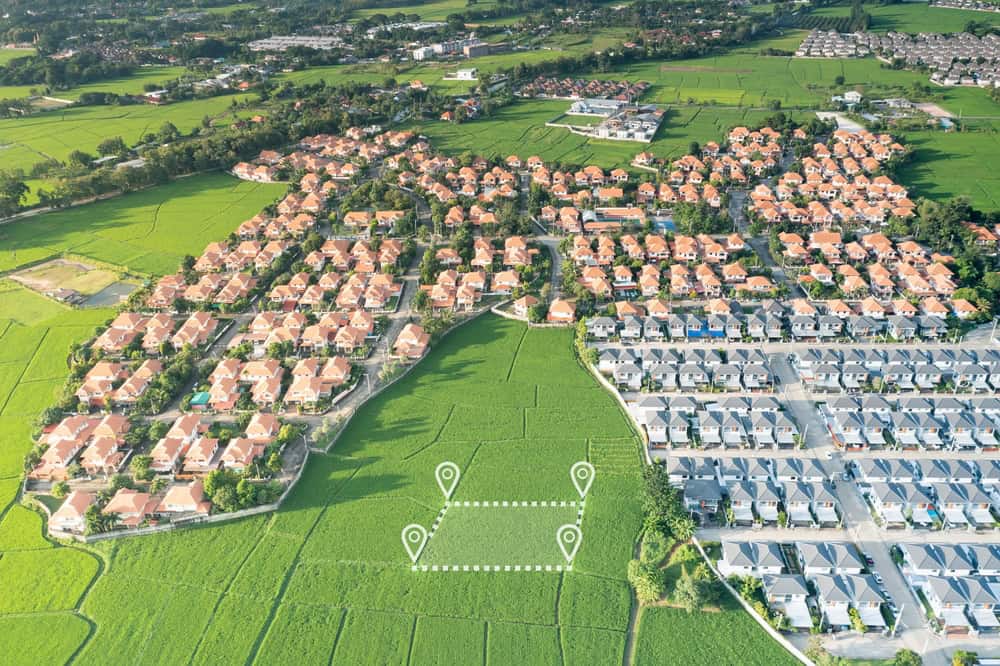
A property surveyor is a licensed professional responsible for measuring and mapping land, determining property boundaries, and identifying features and legal restrictions on a piece of property. We play a critical role in the real estate, construction, and land development industries by ensuring accurate boundary lines and providing data to guide property transactions.
Think of us as your property’s detective. Property surveyors define and confirm the legal boundaries of land by measuring and comparing physical features against descriptions in deeds, titles, and historical records. Using specialized tools such as GPS, laser scanning, and theodolites, we precisely measure land and create detailed maps, or plats, that depict property lines, existing structures, and natural features.
This isn’t just about drawing lines on paper. We provide essential data and documentation that protect property rights, prevent disputes, and support safe, legal property development.
Why Martin County Property Buyers Skip Surveys and Regret It Later
Florida home buyers are not required by law to survey their residential property before they close on their new home. However, it’s a good idea to do so because any number of issues can materially affect the value of the property and the ability to sell it.
Here’s what happens when buyers skip this step. Some property buyers in Florida skip surveys and home inspections to make their offers more competitive. But, they often regret not getting a survey, even though it’s not required by law. The reasons become clear once you understand what you’re actually buying.
Surveys show property lines and details, preventing disputes with neighbors. They also check if structures meet laws and permits. Without this information, you might discover your dream deck actually sits on your neighbor’s land, or that beautiful fence you love is actually your responsibility to maintain.
Even worse, if you’re financing a land purchase, your lender or title insurance company will most likely require a land survey. Without a land survey, you can’t get title insurance coverage for boundary disputes that a survey would have detailed. This means you could be stuck with expensive legal problems that insurance won’t cover.
The financial reality is sobering. Boundary disputes can arise due to various factors, including unclear or poorly defined property descriptions, conflicting surveys, encroachments, adverse possession claims, or disagreements over boundary lines established by previous owners. These disputes often cost far more to resolve than the original survey would have cost.
The Hidden Costs of Not Getting a Property Survey in Florida
The numbers tell a stark story about why surveys matter. The average cost of a land survey in Florida is $500, with most homeowners spending between $500 and $1,000 on a land survey. Compare that to what you’ll face without one.
Boundary disputes are becoming more common in Florida due to rapid population growth, diverse property uses, and complex land development patterns. When these disputes arise, you’re looking at legal fees, court costs, and potential property modifications that can easily run into tens of thousands of dollars.
Consider what a survey actually reveals that could save you money. Surveys will reveal the utilities existing on the land. These include underground drains, sewer systems, power cables, and above-ground utility poles and wiring. Upon taking ownership, you are subject to the rules and regulations of these utilities. If the Florida utility provider has the right of access to the site, then it may have the power to force you to cut back trees as well as limit where additional improvements can be built.
Easements are established under Florida law as an implied grant of access on the land to another person or entity. In a survey, easements will be shown and described insofar as who has the right of access on the property, the extent of the easement, and its basis. Hidden easements are not easily seen by a walk around the land itself.
Without knowing about these easements and utility rights, you might plan expensive landscaping or construction projects only to discover they’re not allowed. The survey cost starts looking like the bargain it actually is when you consider these potential issues.
Different Types of Property Surveys and When You Need Each One
Not all surveys are created equal, and understanding the differences can save you both money and headaches. An ALTA (American Land Title Association) survey is done when buying a home or investment property. A title company will normally require an ALTA survey before issuing title insurance. An ALTA survey may also be referred to as a mortgage survey since lenders often require them before providing financing.
The type of survey you need depends on your specific situation and what your lender or title company requires. American Land Title Association (ALTA) surveys are typically performed when you are buying a home. Also known as a mortgage survey, title companies typically require these to be done before issuing title insurance. Many lenders will also require an ALTA survey before they will provide financing for the mortgage.
Each survey type serves different purposes, and choosing the right one ensures you get the information you need without paying for unnecessary details.

Boundary Surveys vs ALTA Surveys: What Martin County Buyers Need to Know
A boundary survey is used to determine the exact location of property boundaries and corners of a piece of land. A boundary survey may be used to settle legal disputes or locate easements or for personal records. This is often the most cost-effective option for straightforward residential purchases.
However, while an ALTA survey is the most thorough type of boundary survey commonly used, it is usually cost prohibitive for non-commercial property. ALTA surveys are some of the most comprehensive and take time. Often, commercial property buyers or homebuyers or sellers who need a survey to deal with a title dispute will have ALTA surveys done. On average, they cost from $2,500 to $10,000.
The key difference lies in what each survey includes. A location survey is similar to a boundary survey, but it also includes site improvements. The location survey shows the location and size of improvements and the distance measurements between them and the property lines. Property owners often use a location survey for zoning permits.
For most Martin County residential buyers, a standard boundary survey provides adequate protection. However, if you’re dealing with complex property issues, commercial property, or your lender specifically requires an ALTA survey, the additional cost provides comprehensive protection. ALTA surveys are generally more expensive than something like a boundary survey because of the extra time and effort that goes into researching existing documentation and the number of details that have to be provided.
The decision often comes down to your lender’s requirements and your risk tolerance. A boundary survey catches most issues that affect residential buyers, while an ALTA survey provides the most comprehensive protection available.
How Long Does a Property Survey Take and Who Pays for It
Timing matters when you’re trying to close on property, and surveys can affect your closing timeline. Standard surveys take 1–2 weeks, but it may be longer during busy seasons or for rural or large properties. Smart buyers factor this into their closing timeline rather than rushing the process.
The question of who pays often creates confusion between buyers and sellers. If you’re selling a property and the buyer wants a survey of your land, they are responsible for footing the bill. That applies to situations in which one party contacts the survey company on another’s behalf. Landowners are usually the ones actually ordering the survey, but buyers usually have to pay them back or give the money directly to the survey company.
However, sellers sometimes proactively order surveys to attract interested parties. Just because there’s a general way things go doesn’t mean it’s a hard and fast rule. Some sellers or buyers are willing to negotiate or split the cost of a survey.
Many people wonder who will have to pay for a required land survey when buying or selling a home. Who has to pay will differ from state to state, but, in most areas, the buyer is responsible for paying for the services, or it is negotiable between the two parties.
The key is addressing this early in negotiations rather than discovering payment responsibility at the last minute. If you’re the buyer, budget for survey costs as part of your closing expenses. If you’re concerned about timing, consider ordering the survey as soon as your offer is accepted rather than waiting until the last minute.
Making the Smart Choice: Your Next Steps for Property Survey Success
In most cases, you absolutely need a land survey when you purchase a piece of property in North Florida. Having a land survey gives you the information you need about your property. You can refer back to it if there’s ever a dispute in the future, as well. The same logic applies throughout Florida, including Martin County.
The investment in a professional survey protects far more than just your property boundaries. It provides peace of mind, satisfies lender requirements, prevents costly disputes, and ensures you truly understand what you’re buying. With careful planning and a skilled professional, you can get a precise survey that protects your property rights.
When you’re ready to move forward with your Martin County property purchase, don’t leave this critical step to chance. Contact us at Aero Land Surveyors to discuss your specific needs and ensure your investment is properly protected from day one.