Summary:
Why Land Surveying is Critical for Florida Development Projects
Florida’s rapid growth brings unique challenges that make professional surveying essential. Florida continues to be one of the fastest-growing states, with developers shaping landscapes in cities across the state. But this growth comes with complexity.
Florida’s unique terrain, coastal exposure, and rapid urban development make accurate land surveying essential, ensuring project boundaries are correct and protecting from legal disputes while satisfying local permitting agencies. Without proper surveying, you’re building on assumptions rather than facts.
The stakes are particularly high in counties like Martin, Okeechobee, and Indian River, where land values can reach $223,208 per acre in Martin County, making accuracy not just important—it’s financially critical.
Understanding Property Boundaries and Legal Requirements in Florida
Property boundaries aren’t just lines on a map—they’re legal definitions that determine what you own, what you can build, and where potential problems might arise. Boundary surveys must conform to the Minimum Technical Standards (MTS) set by the Florida Administrative Code (FAC), Rule 5J-17.050-053.
In Florida, there may be land records with surveys that are outdated and not as accurate as those done today with technological advances, and land markers may have moved over time, with surveys identifying discrepancies between recorded instruments and the ground itself. This is why you need current, professional surveying.
Boundary disputes are common in South Florida due to dense development, and to resolve these disputes, a professional boundary survey may be required. We research historical records, conduct physical surveys, and prepare reports that can be used in legal proceedings if necessary.
Professional surveyors use advanced technology including GPS, laser scanning, and theodolites to precisely measure land and create detailed maps. We identify encroachments like buildings or fences extending over property lines, record easements or rights-of-way, and prepare comprehensive survey reports and maps necessary for title insurance, property transactions, and construction permits.
The process involves thorough research of current property deeds, title searches detailing ownership history, and physical site visits to create accurate drawings. We include drawings in survey reports with information such as street addresses, descriptions of neighboring property, improvements made to the property, and any easements.
Navigating Environmental and Zoning Challenges in Coastal Florida
Florida’s environmental regulations add layers of complexity that many developers underestimate. South Florida has unique geographic and environmental challenges, known for coastal areas, wetlands, high water tables, and hurricane risks.
South Florida’s proximity to the ocean and abundance of wetlands mean many properties are subject to additional environmental regulations, with surveys in these areas requiring wetland delineation to determine boundaries and ensure compliance with state and federal regulations like the Clean Water Act.
Much of Florida lies within flood-prone areas, and failing to conduct elevation surveys or ignoring FEMA floodplain maps can result in significant delays in permitting. In flood-prone areas, elevation certificates are often required to determine flood risk and insurance rates, adhering to FEMA guidelines and typically required by local municipalities for construction permits in designated flood zones.
Your surveyor needs to understand these environmental factors because your site may legally include land that is unusable due to utility easements or public access rights, and a proper survey will uncover these limitations. This knowledge prevents costly surprises during development.
Local zoning changes can also impact your project significantly. In one case, a local zoning change altered setback requirements and affected usable land area, and updating the survey and advising on new compliance steps avoided resubmitting plans, which would have delayed the project by three months.
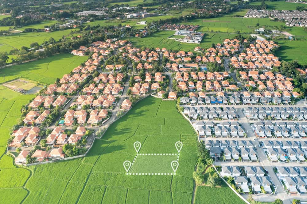
Essential Survey Types for Land Development and Site Planning
Different development phases require different surveying approaches. Understanding which surveys you need—and when—can save time, money, and prevent regulatory headaches. Local building departments and permitting agencies in Florida often require boundary surveys to confirm legal property lines, topographic surveys showing elevation and contour information, and ALTA/NSPS surveys required for commercial transactions and financing.
The key is matching the right survey type to your specific project needs and timeline. Each serves a distinct purpose in the development process, from initial site assessment through final construction.

Topographic Surveys for Site Planning and Development Design
Topographic surveys provide the foundation for intelligent site planning by revealing the natural characteristics of your land. Topographic surveys provide information about contours, elevations, and physical features of a property, crucial for development projects.
Topographic surveys provide information about contours, elevations, and physical features of a property, are crucial for development projects especially in areas with unique geographic features like wetlands or flood zones, and must comply with MTS standards and include detailed elevation data.
These surveys are particularly important in Florida where the state has particular requirements for residential utilities placement because of unique environmental characteristics, with the Florida Division of Water Resource Management overseeing protection of drinking water quality as well as ground water and wetlands.
A skilled topographic surveyor brings more than technical expertise. A good topographical land surveyor possesses technical expertise, attention to detail, and problem-solving skills, with technical knowledge of advanced surveying tools like GPS, laser scanning, and GIS software allowing precise mapping of land contours and features, where accuracy is critical to ensure each measurement is correct and avoid costly errors during planning or construction.
Adaptability is key as surveying can present unexpected challenges like uneven terrain or hidden features, requiring surveyors to think quickly and find practical solutions, while effective communication skills allow surveyors to clearly explain complex findings to clients. Knowledge of local regulations is valuable, helping surveyors identify compliance issues and advise on legal requirements for building or developing land.
ALTA Surveys and Commercial Development Requirements
Commercial development and financing often require ALTA/NSPS Land Title Surveys, which provide the most comprehensive property analysis available. ALTA/NSPS Land Title Surveys are often required for commercial real estate transactions, conducted according to standards set by the American Land Title Association (ALTA) and National Society of Professional Surveyors (NSPS), providing detailed information about property boundaries, improvements, easements, and encroachments often required by title insurance companies.
An ALTA Land Title Survey is completed based on “Minimum Standard Detail Requirements and Accuracy Standards For ALTA/NSPS Land Title Surveys,” with ALTA surveys priced from 50% to 250% more than comparable boundary surveys, depending on items checked in “Table A – Optional Survey Responsibilities and Specifications”.
The investment in an ALTA survey pays dividends in commercial transactions. One item usually included with most ALTA survey requests is Item #1, monuments placed, and clients are supposed to fill out Table A and furnish title documents to the surveyor before starting the survey.
These comprehensive surveys are essential for commercial lending because they provide lenders with detailed information about potential risks, easements, encroachments, and property improvements. The thorough documentation protects all parties in the transaction and ensures compliance with commercial real estate standards.
For developers working on larger projects, ALTA surveys provide the detailed foundation needed for complex financing arrangements and help identify potential issues before they become costly problems during construction or at closing.
Choosing the Right Land Surveyor for Your Florida Development Project
The right land surveyor does more than measure property—we become your partner in navigating Florida’s complex development landscape. Look for surveyors who understand local regulations, use modern technology, and communicate clearly throughout the process.
Every Florida developer must understand that local surveying regulations are foundational to project success, as failing to comply can result in unexpected delays, additional costs, and legal complications, making working with experienced surveyors who know both the physical and regulatory landscape the best strategy for keeping development on track.
When you’re ready to move from cleared land to closing, Aero Land Surveyors brings the expertise, technology, and local knowledge needed to support your development success in Martin County, Okeechobee County, and Indian River County.