Summary:
What Causes Boundary Disputes in Florida
Boundary disagreements arise from mistaken beliefs about property lines, new construction, natural landscape changes, or lack of clear legal descriptions. In Florida’s dynamic environment, these issues are particularly common.
Survey errors and deed ambiguities frequently lead to boundary disputes when inaccurate surveys fail to identify correct boundaries or unclear deed descriptions conflict. Florida’s frequent storms and erosion alter landscapes over time, potentially changing property lines as understood by physical markers.
Most disputes start innocently. You want to install a fence, your neighbor builds a shed, or someone discovers an old survey that doesn’t match current assumptions about property lines.
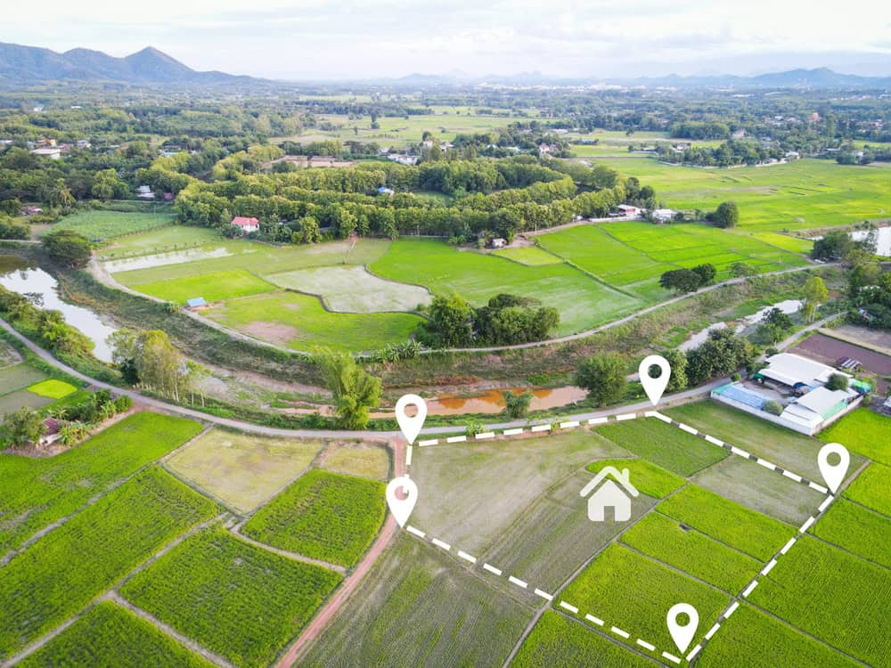
Common Types of Property Line Conflicts
Encroachments occur when structures extend onto adjacent properties, easement conflicts arise over shared access rights, and fence disputes develop over placement and ownership. These situations create immediate tension between neighbors and can significantly impact property values.
Encroachment issues are particularly problematic because they often go unnoticed for years. Your neighbor’s deck, driveway, or garden may have gradually expanded onto your property, creating a complex legal situation. Adverse possession claims can arise when someone wrongfully occupies property for extended periods, potentially affecting your legal ownership rights.
Property disputes typically escalate when improvements like walls, fences, or pools are built without proper permits, city approval, or consideration of actual property lines. What starts as a simple home improvement project can become a legal nightmare if boundaries aren’t clearly established first.
Natural boundaries add another layer of complexity. Roads, ponds, or lakes used as property markers can change over time due to weather, making boundary lines impossible to spot visually. In Martin County, Okeechobee County, and Indian River County, where weather patterns regularly reshape the landscape, these natural changes create ongoing challenges for property owners.
Why Boundary Disputes Escalate Quickly
When boundary disputes occur, they sour neighborly relations and impact property value and enjoyment. What begins as a simple question about property lines can quickly become an emotional and financial burden for everyone involved.
The stakes are high because your property represents significant financial investment. For many Floridians, property reflects hard work, aspirations, and financial security. When that investment feels threatened by boundary uncertainty, emotions run high and rational discussion becomes difficult.
Boundary disputes are rarely the initial catalyst for neighbor conflicts – they typically emerge when property improvements are made. The timing creates additional pressure because construction projects, real estate transactions, or insurance claims often depend on resolving boundary questions quickly.
Legal costs compound the problem. Whether you win or lose a boundary lawsuit, you may live next to the other party for years, and litigation takes substantial time and money. Professional surveys provide a path to resolution that preserves relationships while protecting legal rights.
Without clear boundaries, simple property maintenance becomes complicated. You can’t confidently install fencing, plan landscaping, or make improvements when you’re uncertain about your actual property limits.
How Professional Surveys Resolve Boundary Disputes
Accurate property surveys serve as vital foundation for establishing and resolving boundary disputes by determining precise boundary lines and resolving disputes based on factual evidence. We use advanced technology and legal expertise to create definitive documentation that courts and neighbors respect.
Boundary surveying precisely identifies and establishes legal property boundaries, determining exact property line locations and marking those lines on the ground. This process transforms confusion into clarity, providing the concrete evidence needed to resolve disputes definitively.
Modern surveying technology ensures accuracy that old surveys and assumptions simply can’t match. The investment in professional surveying typically costs far less than legal disputes while providing lasting peace of mind.
The Professional Survey Process
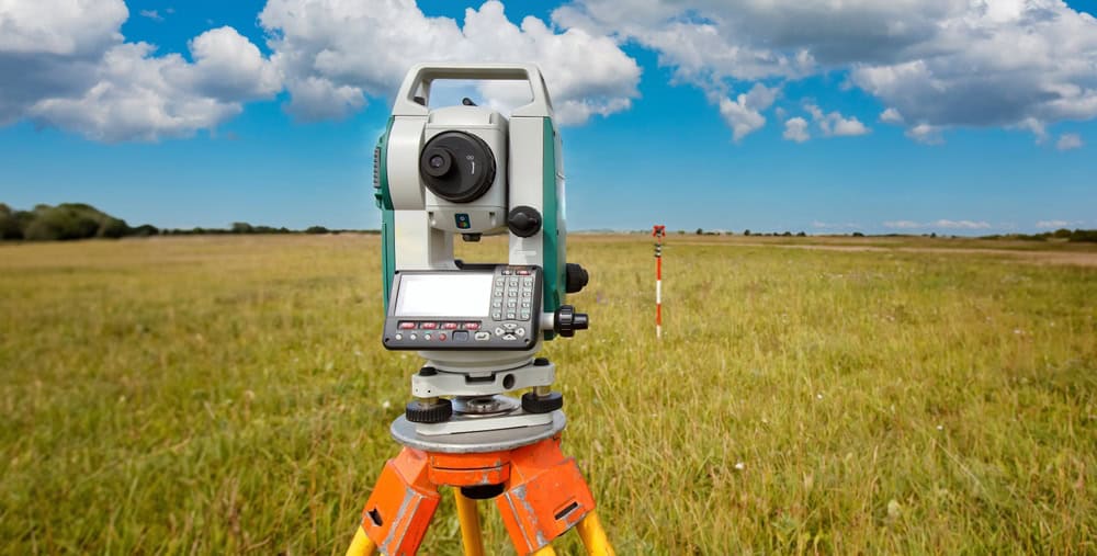
We define and confirm legal boundaries by measuring and comparing physical features against deed descriptions, titles, and historical records using specialized tools like GPS, laser scanning, and theodolites. This comprehensive approach ensures accuracy and legal defensibility.
We begin with extensive research, examining property deeds, historical surveys, and public records to understand your property’s legal description. Thoroughly reviewing property documents including deeds, title reports, and relevant agreements is essential to understand property rights and obligations, as these documents contain vital boundary descriptions and easements.
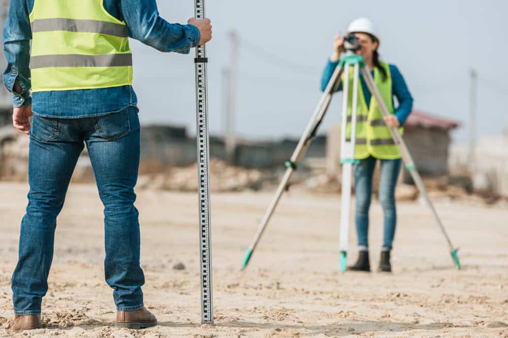
Field work follows the research phase. We precisely measure land and create detailed maps depicting property lines, existing structures, and natural features while identifying encroachments like buildings or fences extending over property lines. We also record easements and rights-of-way that may affect property use.
The final survey report provides comprehensive documentation that serves multiple purposes. It establishes legal boundaries for current disputes, provides reference for future property decisions, and creates valuable documentation for insurance, real estate transactions, and legal proceedings.
We are experienced in interpreting complex legal property descriptions and use cutting-edge technology to demarcate property lines accurately. This expertise proves invaluable when dealing with complicated boundary questions that have stumped property owners for years.
Survey Technology and Accuracy
Modern surveying uses GPS, laser scanning, and theodolites to precisely measure land and create detailed property maps. This technology provides accuracy levels that far exceed traditional surveying methods, ensuring reliable results that stand up to legal scrutiny.
GPS technology allows us to establish precise coordinate positions that integrate with official mapping systems. 3D laser scanning captures detailed terrain information and identifies features that might affect boundary determinations. These tools work together to create comprehensive property documentation that addresses both current disputes and future needs.
The accuracy of modern surveying technology means survey results are legally defensible and widely accepted by courts, insurance companies, and real estate professionals. We offer insights and expertise that help property owners make smart decisions while identifying issues that might otherwise be missed, protecting investments and avoiding legal trouble.
We understand Florida’s specific legal requirements and surveying regulations. Florida Statutes § 177.28(1) establishes legal requirements for determining property boundaries, while Florida Administrative Code Chapter 5J-17 provides comprehensive rules for surveyors and mappers. This specialized knowledge ensures our survey work meets all legal standards.
Documentation quality matters significantly in boundary disputes. Professional surveys provide detailed reports, maps, and legal descriptions that clearly communicate boundary determinations to all parties. This documentation serves as authoritative reference for resolving current conflicts and preventing future disputes.
Protecting Your Property Investment with Professional Surveys
Professional land surveys prevent boundary disputes with neighbors and preserve relationships by providing readily available documentation that prevents legal proceedings. The investment in accurate boundary determination protects both your property value and your peace of mind.
A land survey ensures you know exactly what’s yours, helping avoid costly mistakes or boundary disputes down the road. This knowledge empowers confident property decisions and eliminates the stress of boundary uncertainty.
When you’re facing boundary questions or disputes in Martin County, Okeechobee County, or Indian River County, professional surveying provides the clear answers you need. We combine advanced technology with local expertise to deliver accurate, timely results that protect your property investment and resolve conflicts definitively.