Summary:
What Drone Surveying Actually Does for Land Surveys
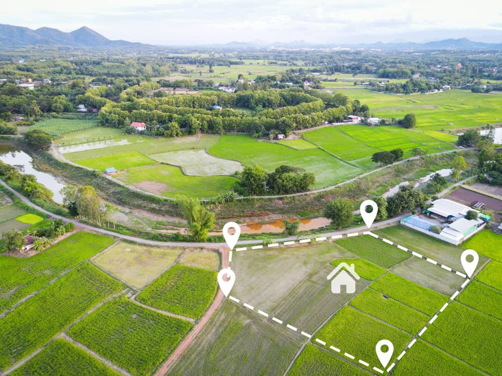
Drone surveying uses unmanned aerial vehicles equipped with high-resolution cameras and sensors to capture data from above. Instead of walking every inch of your property with traditional equipment, a licensed pilot flies a drone along a planned route while it photographs and measures the terrain below.
The drone isn’t just taking pictures. It’s collecting precise spatial data—coordinates, elevations, distances—that software turns into accurate maps and 3D models. What used to require a full crew and multiple site visits now happens in a single flight that might last 15 to 30 minutes for a typical residential property.
For properties in Florida where terrain can be challenging—wetlands, dense vegetation, steep slopes—drones access areas that would be difficult or dangerous for surveyors on foot. That means more complete data and fewer gaps in coverage.
How Accurate Are Drone Surveys Compared to Traditional Methods
Accuracy matters when you’re defining legal property boundaries or planning construction. The question isn’t whether drones can match traditional surveying—it’s understanding when and how they deliver comparable or better results.
Modern drone systems routinely achieve accuracy within 0.02 feet when properly calibrated with ground control points. That’s centimeter-level precision, matching what traditional total stations provide. The difference is that drones capture data across your entire site rather than at selective points.
Traditional methods rely on measuring specific locations and interpolating between them. Drones photograph everything, creating a dense dataset with millions of measurements. You’re not getting less accuracy—you’re getting more complete information about your property.
The key is using professional equipment and licensed surveyors who understand how to process the data correctly. Consumer drones won’t deliver survey-grade results. Professional systems with GPS correction, proper flight planning, and expert processing do. That’s why working with a licensed surveyor who uses advanced technology matters—we know how to ensure the data meets legal standards for boundary determination and construction planning.
In Florida, where property markers can shift due to storms, construction activity, and ground settling, having comprehensive data about your entire property provides better protection than spot measurements alone. When boundary disputes arise—and up to a third of Florida homebuyers experience them within the first year—courts rely on professional survey evidence. Modern drone surveys provide that documentation with the added benefit of visual context that makes the data easier to understand.
What Drone Surveys Can and Cannot Replace in Traditional Surveying
Drones excel at capturing topographic data, creating site maps, and documenting existing conditions over large areas. They’re ideal for preliminary site assessments, construction monitoring, ALTA surveys on suitable properties, and situations where you need a comprehensive overview of terrain and improvements.
But drones don’t replace every aspect of traditional surveying. Boundary surveys still require physical monumentation—placing markers at property corners. A surveyor needs to visit the site, research property records, locate or set monuments, and verify boundary lines on the ground. Drones support this work by providing detailed aerial context, but they don’t eliminate the need for licensed surveyors to establish legal boundaries.
Dense tree canopy can also limit what drones see. In heavily forested areas, laser pulses may not penetrate to the ground surface, requiring traditional methods or ground-based laser scanning to capture accurate terrain data beneath the vegetation.
The reality is that modern surveying combines tools. A comprehensive survey might use drones for aerial mapping, GPS for establishing control points, and traditional instruments for boundary verification. Each technology serves a purpose, and we know which tools fit each situation.
For property owners, this means you’re not choosing between old and new methods. You’re benefiting from surveyors who use the right technology for your specific needs. A residential boundary survey in a suburban neighborhood might rely primarily on GPS and traditional instruments. A large development site might use drones extensively. A property with dense vegetation might need a combination approach.
What matters is working with surveyors who have access to multiple technologies and the expertise to apply them appropriately. That’s how you get accurate results regardless of your property’s characteristics or the type of survey you need.
How GPS and 3D Laser Scanning Improve Survey Accuracy
GPS technology transformed surveying by providing accurate positioning data from satellites. Modern GPS receivers used in surveying are far more sophisticated than the navigation systems in your phone or car. They connect to multiple satellite constellations and use correction signals to achieve centimeter-level accuracy.
Real-time kinematic (RTK) GPS is the current standard for survey work. It uses a base station and mobile receiver working together to eliminate atmospheric interference and other errors. The result is positioning data accurate within 1-2 centimeters—precise enough for legal boundary work and construction layout.
3D laser scanning adds another dimension. The scanner emits millions of laser pulses that bounce off surfaces and return to the device. By measuring the time each pulse takes to return, the scanner calculates exact distances and creates a dense “point cloud”—a collection of millions of precisely measured points that form a detailed 3D model of the scanned area.

Why GPS Surveys Work Better for Florida Properties
Florida presents specific challenges for land surveying. The state’s flat terrain, frequent storms, and environmental factors can affect property markers over time. Traditional surveying methods that rely on line-of-sight measurements can struggle in areas with dense vegetation or when reference points are far apart.
GPS technology works regardless of visibility between survey points. As long as the receiver has a clear view of the sky, it can determine its position accurately. This makes GPS particularly valuable in Florida’s varied terrain—from coastal properties to inland areas with heavy vegetation.
The technology also provides consistency. Traditional measurements accumulate small errors over distance. GPS determines each point’s position independently based on satellite signals, so errors don’t compound. For large properties or surveys covering multiple parcels, this independence improves overall accuracy.
Weather is less of a limitation than you might expect. While heavy storms can temporarily interfere with satellite signals, GPS generally works in overcast conditions that would slow traditional surveying. The technology also handles Florida’s heat and humidity without the physical fatigue that affects field crews during long summer days.
For property owners in Martin County, Okeechobee County, and Indian River County, GPS surveying means faster results and confidence that measurements are consistent across your entire property. Whether you’re establishing boundaries, planning development, or resolving disputes, GPS provides the accurate positioning data that modern surveys require. Combined with traditional boundary research and monumentation, it delivers reliable results that meet Florida’s legal standards.
What 3D Laser Scanning Captures That Traditional Methods Miss
Traditional surveying measures discrete points—specific locations chosen by the surveyor as representative of the terrain. The surveyor then connects those points to create a map. It’s efficient, but it means some details between measured points might be missed or estimated.
3D laser scanning captures everything within the scanner’s view. Instead of hundreds of measured points, you get millions. Every slope, elevation change, and surface feature is recorded with millimeter precision. The resulting point cloud provides a complete digital representation of your property’s topography and improvements.
This comprehensive data is particularly valuable for complex projects. If you’re planning a building addition, the scan shows exact elevations and the relationship between existing structures and the surrounding land. For drainage planning, it reveals subtle grade changes that affect water flow. For as-built documentation, it records actual conditions rather than design specifications.
The technology also creates a permanent digital record. Years later, if you need information about your property’s condition at a specific time, the point cloud data remains available. You can take measurements, create cross-sections, or generate new drawings without returning to the site. This is especially useful for phased construction projects or properties that undergo gradual changes.
Speed is another advantage. A laser scanner can capture a typical residential property in an hour or two, including setup time. Processing the data takes additional time, but the fieldwork is significantly faster than traditional methods would require to achieve similar detail. For commercial properties or large sites, the time savings become even more substantial.
The result is survey data that’s more complete, more detailed, and more useful for planning and decision-making. You’re not guessing about conditions between measured points—you have actual data for every visible surface on your property.
Making the Right Choice for Your Land Survey Needs
Technology has changed what’s possible in land surveying, but the fundamentals remain the same. You need accurate information about your property boundaries, topography, and improvements. You need that information delivered by licensed professionals who understand Florida’s surveying regulations and legal requirements.
The difference now is that modern tools deliver results faster and with more comprehensive data than traditional methods alone could provide. Drones, GPS, and 3D laser scanning aren’t replacing the expertise of licensed surveyors—they’re enhancing what we can do for you.
Whether you’re buying property in Martin County, planning development in Okeechobee County, or resolving boundary questions in Indian River County, working with surveyors who use advanced technology means you get better information in less time. That’s what we provide at Aero Land Surveyors: the combination of modern surveying technology with the licensing, experience, and local knowledge that accurate surveys require.