Summary:
What Licensed Land Surveyors Actually Do
Professional land surveyors make exact measurements and determine property boundaries. We provide data about the shape, contour, location, elevation, and dimension of land features for engineering, construction, real estate transactions, and legal purposes.
In Florida, licensed land surveyors are regulated by the Florida Department of Agriculture and Consumer Services. This means we’ve met strict educational requirements, passed rigorous examinations, and maintain ongoing professional standards. You’re not just hiring someone with measuring equipment—you’re working with a licensed professional whose work carries legal weight.
Our job involves researching property records, conducting fieldwork with specialized equipment, analyzing data, and creating detailed reports that courts, title companies, and government agencies recognize. When boundary disputes arise or construction projects need permits, surveyor documentation provides the legal foundation everything else builds on.
How Property Survey Experts Establish Accurate Boundaries
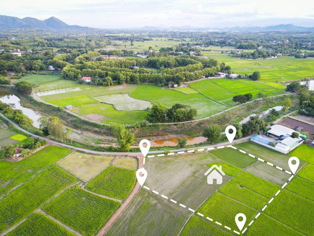
Establishing accurate property boundaries starts long before we arrive at your property. We begin by researching land titles, deeds, and historical records to understand the legal description of your property. This research phase uncovers previous surveys, recorded plats, and any easements or encroachments that might affect your land.
Once we understand the legal framework, we head to the field with GPS equipment, total stations, and sometimes 3D laser scanners. We’re looking for existing boundary markers—iron rods, pipes, or concrete monuments placed during previous surveys. When we find these markers, we verify their positions against legal descriptions and historical data.
Property boundaries aren’t always where you think they are. Fences don’t necessarily follow property lines. That tree you’ve been maintaining for years might actually be on your neighbor’s land. Tax maps can be outdated by decades, showing property dimensions that don’t match actual legal descriptions. We locate the true legal boundaries regardless of where physical features suggest they should be.
Modern GPS technology has transformed this process. Professional-grade GPS systems used in land surveying achieve centimeter-level accuracy, far beyond what your phone can do. These systems use real-time kinematic positioning with base stations that correct for atmospheric conditions and satellite drift. The result is precision you can stake your property rights on—literally.
After collecting field data, we analyze measurements, resolve any discrepancies between historical records and current conditions, and create detailed maps showing your exact property lines. We mark corners with permanent monuments and prepare survey reports that document our findings. This documentation becomes the legal record of your property boundaries.
The process also identifies potential problems before they become expensive mistakes. Encroachments where structures cross property lines, easements that restrict how you can use portions of your land, and setback violations that could prevent construction—we catch these issues early when they’re still manageable. In rapidly developing areas of Martin County, Indian River County, and Okeechobee County, this early detection saves homeowners and developers thousands of dollars in corrections and legal fees.
GPS and 3D Laser Scanning Technology That Delivers Survey-Grade Accuracy
The technology professional land surveyors use today would seem like science fiction to surveyors from even twenty years ago. GPS and 3D laser scanning have fundamentally changed how quickly and accurately we can work.
GPS technology for surveying operates differently than the GPS in your car or phone. Survey-grade GPS systems use multiple satellite signals combined with ground-based correction stations to achieve accuracy measured in centimeters, not meters. In clear sky conditions, these systems can pinpoint locations with precision that makes traditional measurement methods look rough by comparison.
Real-time kinematic GPS, or RTK, takes this further. Base stations transmit correction data to roving units in the field, compensating for atmospheric interference and satellite positioning errors. This means we can establish control points and measure property features with confidence that our data will hold up under legal scrutiny.
3D laser scanning captures millions of data points in minutes, creating detailed digital representations of terrain, structures, and site features. A laser scanner emits pulses of light that bounce off surfaces and return to the device. By measuring the time each pulse takes to return, the scanner calculates precise distances and creates what’s called a point cloud—a three-dimensional map of everything the scanner can see.
This technology excels in situations where traditional surveying would be slow, dangerous, or impractical. Need to survey a busy roadway, a steep hillside, or a complex structure? Laser scanning captures comprehensive data from a safe distance in a fraction of the time traditional methods require. For topographic surveys showing elevation changes, drainage patterns, and site features, 3D scanning delivers detail that helps architects and engineers design better projects.
The data from these technologies integrates with CAD and BIM software, creating seamless workflows from field to final design. Engineers can import survey data directly into their design programs. Architects can visualize how their plans fit actual site conditions. Contractors can prepare accurate bids based on real measurements instead of assumptions.
For property owners in Martin County, Indian River County, and Okeechobee County, this technology means faster turnaround times without sacrificing accuracy. What used to take days or weeks of fieldwork can now be completed in hours. The comprehensive data means fewer return visits to capture missed details. And the precision helps prevent the costly mistakes that come from working with inaccurate information.
Advanced technology also improves safety. We can collect data from hazardous locations without putting ourselves at risk. We can work more efficiently in challenging Florida weather conditions. And we can document site conditions so thoroughly that questions arising months later can often be answered from existing data without requiring new fieldwork.
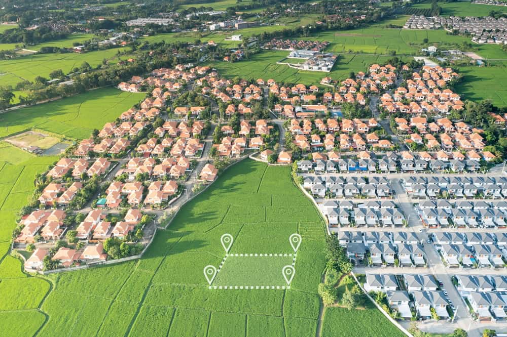
Land Surveyor Services: Choosing the Right Survey Type
Not all surveys serve the same purpose. Understanding which type of survey you need saves time and money while ensuring you get documentation that actually solves your problem.
Boundary surveys identify exact property lines and mark them with physical monuments. This is what most homeowners need when installing fences, planning additions, or resolving disputes with neighbors. We locate property corners, measure the lines between them, and create a map showing where your property begins and ends. Most residential boundary surveys in Florida cost between $500 and $1,100.
Mortgage surveys are simpler and less detailed. Lenders often require these when you’re buying property with financing. They show the house location relative to property lines and identify obvious encroachments or easements, but they don’t include the comprehensive detail of a full boundary survey.

Topographical Surveys for Construction Planning and Development
Topographical surveys create detailed three-dimensional maps showing your property’s elevations, slopes, drainage patterns, and natural features. If boundary surveys answer “where are my property lines,” topographical surveys answer “what does my land actually look like.”
These surveys matter for construction and development because they reveal information you can’t see by walking the property. Water doesn’t flow uphill. Buildings need level foundations. Driveways require proper grades. Topographical surveys provide the elevation data that makes smart design possible.
We use GPS technology and 3D laser scanning to capture precise elevation measurements across your entire property. We map every contour, slope, and elevation change to create detailed terrain models. The result shows exactly how water moves across your land, where high and low points are, and how natural features affect your development options.
This information helps architects design buildings that work with your land instead of fighting against it. Engineers can plan proper drainage to prevent flooding and erosion. Contractors can prepare accurate bids because they understand actual site conditions instead of making assumptions. And permit applications move faster when they’re supported by accurate topographic data.
For properties in Martin County, Indian River County, and Okeechobee County, topographical surveys become especially important due to Florida’s relatively flat terrain and high water table. Small elevation differences that might not matter elsewhere can significantly impact drainage, flood risk, and construction feasibility here. Understanding these subtle variations prevents expensive problems during construction.
Topographical surveys also document existing features like trees, utilities, structures, and improvements. This comprehensive site documentation ensures your design team knows everything that could affect your project before they finalize plans. It’s much cheaper to adjust designs on paper than to discover problems after construction starts.
The survey data comes in both digital and printed formats, making it easy for your entire project team to access and use. Architects can design around natural features. Engineers can plan proper drainage. Contractors can prepare accurate bids based on real site conditions instead of assumptions.
ALTA Surveys: The Comprehensive Standard for Commercial Properties
ALTA surveys represent the highest standard in land surveying. These comprehensive surveys combine elements of boundary surveys, topographical surveys, and title research to create detailed documentation that commercial real estate transactions depend on.
The American Land Title Association and the National Society of Professional Surveyors jointly establish the standards ALTA surveys must meet. These standards ensure specific levels of accuracy and consistency, which is why lenders, title companies, and commercial buyers require them for significant transactions.
An ALTA survey includes everything a boundary survey shows—property lines, corners, and monuments. But it goes much further. It shows improvements, easements, rights-of-way, access points, utility locations, zoning classifications, flood zones, and any encroachments or boundary disputes. We review title commitments and address specific title exceptions that could affect property ownership or development.
This level of detail costs more and takes longer than a standard boundary survey. But for commercial properties, the investment prevents surprises that could derail transactions or create liability after closing. When you’re investing significant money in commercial real estate, knowing exactly what you’re buying—and what restrictions or issues might affect it—is worth the additional cost.
We certify the ALTA survey to the buyer, lender, title company, and title insurer. This certification provides legal protection for all parties involved in the transaction. If issues arise later, the survey documentation establishes what was known at the time of purchase.
For commercial development in Martin County, Indian River County, or Okeechobee County, ALTA surveys provide the foundation for due diligence. They reveal site constraints before you commit to purchase. They identify opportunities and challenges for development. And they create documentation that supports financing, permitting, and construction.
The optional Table A items in ALTA surveys allow customization based on project needs. You might request building dimensions, setback information, parking space inventory, or underground utility locations. This flexibility ensures the survey addresses your specific concerns while meeting industry standards.
Finding Reliable Land Surveyor Services in Florida
Professional land surveyors protect your property investment by providing accurate, legally recognized documentation of boundaries, elevations, and site conditions. Our work with GPS and 3D laser scanning technology delivers precision that prevents disputes, supports construction, and keeps projects moving forward.
Whether you need a boundary survey for a fence installation, a topographical survey for construction planning, or an ALTA survey for a commercial transaction, working with licensed professionals ensures you get documentation that holds up under legal scrutiny. The technology we use captures comprehensive data efficiently. The expertise we bring interprets that data accurately.
For property owners, developers, and real estate professionals in Martin County, Indian River County, and Okeechobee County, choosing surveyors with local knowledge makes a difference. Understanding county regulations, typical property issues, and regional characteristics helps us provide better service and more useful documentation. When you need surveying services that protect your interests and support your goals, we bring the licensing, technology, and expertise your project deserves.