Summary:
Your property represents a significant investment. Before you break ground on construction, settle a boundary dispute, or finalize a real estate transaction, you need accurate information about what you actually own and what the land can support.
Traditional surveying methods can take weeks and still leave gaps in the data. Aerial mapping technology changes that equation entirely.
Using advanced GPS systems, 3D laser scanning, and drone platforms, we capture millions of data points across your property in hours instead of days. You get comprehensive elevation models, precise boundary verification, and detailed site analysis that helps architects, engineers, and permitting offices make informed decisions from day one. Here’s what you need to know about how aerial mapping works and why it matters for your Martin County, FL property.
What Aerial Mapping Means for Property Owners
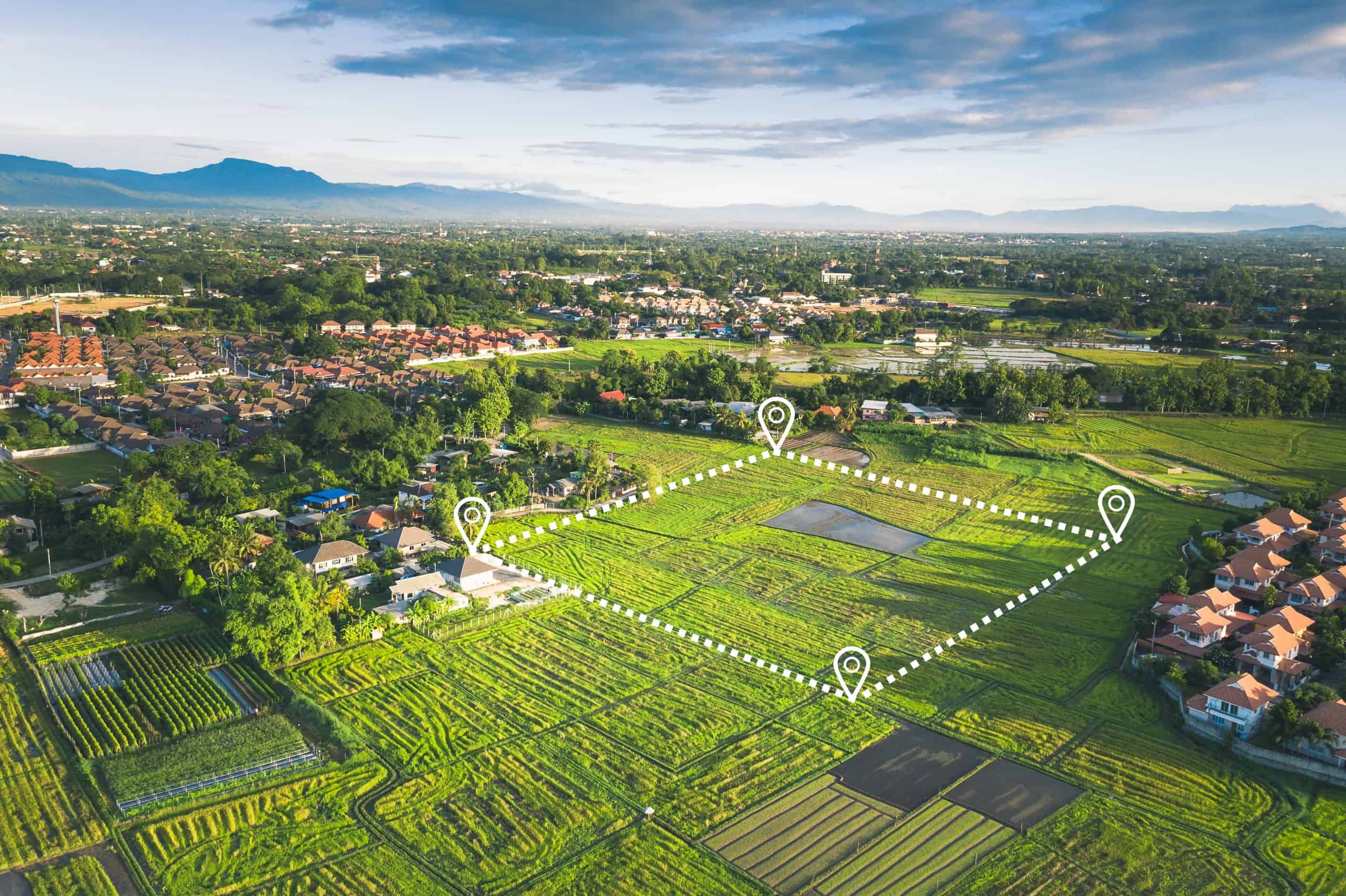
Aerial mapping uses unmanned aircraft equipped with high-resolution cameras, GPS receivers, and laser scanning technology to create detailed three-dimensional representations of your property. Instead of surveyors walking every inch of your land with traditional equipment, a drone flies predetermined paths above your site, capturing overlapping images and precise distance measurements that get processed into accurate maps, elevation models, and boundary documentation.
The technology delivers what property owners actually need: legally defensible survey data that shows exact property lines, elevation changes, drainage patterns, existing structures, vegetation, and site features. This information becomes the foundation for everything from architectural designs to permitting applications to title insurance policies.
For Martin County, FL property owners, this matters because your land decisions have real consequences. Build too close to a property line and you’re facing legal disputes with neighbors or forced structure removal. Miss elevation requirements and you’re dealing with drainage problems or flood zone violations. Aerial mapping gives you the accurate baseline data that prevents these expensive mistakes before they happen.
How Drone Land Surveying Actually Works
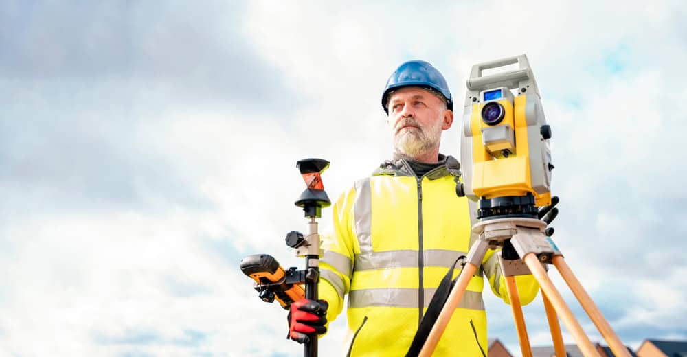
When you hire us for aerial mapping, the process starts with flight planning. Our licensed surveyors review your property boundaries, identify any airspace restrictions, and program a flight path that ensures complete coverage of your site.
The drone flies at specific altitudes—typically 50 to 100 feet above ground level—capturing hundreds or thousands of overlapping images along with precise GPS coordinates for each measurement point. Modern drones carry multiple sensor types depending on your project needs.
Standard RGB cameras capture high-resolution visual imagery for photogrammetric processing. LiDAR sensors emit laser pulses that measure exact distances to the ground, creating dense point clouds with millions of individual elevation measurements. These sensors can penetrate tree canopy and vegetation to capture ground-level data that traditional photography would miss—particularly valuable in Florida’s heavily vegetated areas.
The real power shows up in the processing stage. Specialized software analyzes the captured data, matching overlapping images and laser returns to create georeferenced point clouds. These get transformed into multiple deliverable formats: orthomosaic maps that show your property from directly overhead with consistent scale, digital elevation models that reveal every slope and contour, 3D terrain models that let engineers visualize drainage patterns, and CAD-ready files that architects can import directly into design software.
For a typical residential property in Martin County, FL, the entire flight might take 30 to 60 minutes. Processing usually delivers preliminary results within 24 to 48 hours, with final survey reports following shortly after. Compare that to traditional ground surveys that could require multiple days of fieldwork plus additional processing time, and you start to see why aerial mapping has become the preferred method for many applications.
The accuracy rivals or exceeds traditional surveying when done correctly. Modern drone systems with RTK or PPK GPS correction can achieve vertical accuracy within one-tenth of a foot and horizontal accuracy within three centimeters. That level of precision meets the requirements for most engineering, construction, and legal applications—including the strict standards Martin County, FL applies to development review and permitting.
Using Drones for Surveying vs Traditional Methods
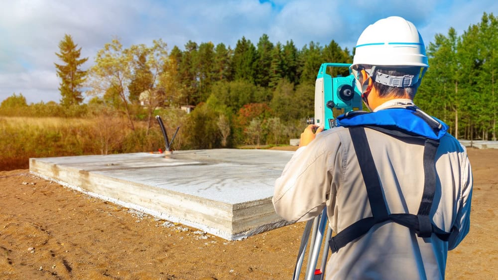
Traditional land surveying relies on surveyors physically walking your property with total stations, GPS rovers, and measuring equipment. They establish control points, measure distances and angles, and manually collect individual data points at key locations.
The process is methodical and proven, but it comes with inherent limitations. Survey crews can only measure what they can physically access and see. Dense vegetation, steep terrain, bodies of water, or hazardous areas create gaps in the data. The final survey represents an interpolation between the points that were actually measured—everything in between those points is essentially an educated estimate.
Using drones for surveying flips that model. Instead of measuring hundreds of individual points and interpolating between them, aerial mapping captures millions of actual measurements across your entire property. You’re not getting estimates of what’s between measurement points—you’re getting real data for nearly every square foot of your site. That density reveals features and elevation changes that ground surveys might miss entirely.
The time difference is dramatic. A traditional topographical land survey on a 10-acre property might require a field crew of three to four people working three to four days to complete. The same property surveyed with a drone could be flown in a few hours, with data processing adding another day or two.
You’re looking at a total timeline of days instead of weeks, and that speed translates directly to cost savings. Traditional methods might run $3,000 to $4,000 in field crew costs alone. Drone surveys on the same property typically cost $100 to $400 for residential sites, with larger commercial properties scaling up from there.
Safety is another factor that matters more than most people realize. Surveyors working on steep slopes, near busy roads, on unstable ground, or in other hazardous conditions face real risks. Falls and injuries are common enough in the surveying industry that insurance costs reflect those dangers. Aerial mapping eliminates most of that exposure. The drone goes into areas that would be dangerous or impossible for people to access, capturing the same data without putting anyone at risk.
That said, traditional surveying still has its place. Establishing legal property boundaries for litigation or title purposes often requires a licensed surveyor to physically locate and verify property corners. Dense tree canopy in some seasons can limit what aerial photogrammetry can capture, though LiDAR technology largely overcomes that limitation.
For many projects, the ideal approach combines both methods: aerial mapping for comprehensive site data and topographic information, with targeted traditional surveying for specific legal boundary verification or detail work in challenging areas.
Topographical Surveyors and What They Map
When you need to understand your land’s physical characteristics—not just where the boundaries are, but what’s actually there—you’re looking for topographical surveyors. A topographic survey maps the three-dimensional features of your property: elevation changes, slopes, contours, existing structures, vegetation, water features, utilities, and anything else that affects how the land can be used or developed.
This information drives critical decisions. Architects need to know where the high and low points are to design foundations that work with the natural grade. Engineers need elevation data to plan drainage systems that move water away from buildings.
Permitting offices in Martin County, FL require topographic surveys to verify that proposed construction meets setback requirements, flood zone regulations, and zoning codes. The survey deliverables typically include contour lines showing elevation changes at specific intervals—often one-foot or two-foot contours for residential properties. You’ll see the location and height of existing buildings, trees, fences, driveways, and other site features. Utility locations get marked when visible or known. The final product gives everyone involved in your project a common reference that answers the question: what are we actually working with here?

Topo Survey Applications for Construction and Development
Before any construction project begins, you need a topo survey to establish baseline conditions. This matters whether you’re building a new home, adding an addition, developing a commercial site, or planning infrastructure improvements. The survey data tells your design team where they can place structures, how to manage stormwater drainage, where retaining walls might be needed, and what site preparation work is required.
Martin County, FL’s development review process requires this information as part of permit applications. Your site plan needs to show existing topography, proposed grading, drainage calculations, and how the finished project will fit within zoning requirements. Without accurate survey data, your application gets delayed or rejected. With it, the review process moves forward on schedule.
The same data serves multiple purposes throughout the construction process. During design, architects use it to orient buildings on the site and plan access points. During permitting, officials verify that your plans comply with local regulations. During construction, contractors use it to establish proper elevations for foundations, utilities, and finish grades. After construction, as-built surveys document what was actually built compared to the original plans.
For property owners, this comprehensive data provides protection. You know exactly what you’re building and where. If questions come up later—from neighbors, from the county, from future buyers—you have documented proof of what the property looked like before construction and what decisions were made based on accurate information. That documentation can prevent disputes or resolve them quickly when they do arise.
In Florida’s flat terrain with high water tables, elevation accuracy becomes even more critical. A difference of just a few inches can determine whether water drains properly away from your foundation or pools against your building. It can affect whether you’re in a flood zone that requires additional insurance or construction standards. Aerial mapping technology captures these subtle elevation changes with the precision needed to make informed decisions.
Topographic Survey Cost Per Acre and Pricing Factors
Understanding what drives topographic survey cost per acre helps you budget appropriately and evaluate proposals from surveying companies. Several factors influence the final price: property size, terrain complexity, vegetation density, required accuracy level, deliverable formats, and timeline expectations.
For drone-based aerial topographic surveys, you’ll typically see pricing in the range of $30 to $120 per acre for standard residential or commercial work. Smaller properties often have higher per-acre costs because there are fixed expenses for mobilization, flight planning, and processing that don’t scale down proportionally.
A one-acre residential lot might run $150 to $400 total. A 50-acre development site might average $50 per acre or $2,500 total. Large-scale projects covering hundreds of acres can drop to $20 to $30 per acre when economies of scale kick in.
Traditional ground-based topographic surveys generally cost more—often $500 to $1,500 for a typical residential property, scaling up significantly for larger or more complex sites. The labor-intensive nature of walking the property and manually collecting data points drives those higher costs. When you factor in the time savings and data density advantages of aerial mapping, the value proposition becomes clear for many applications.
Several factors can push costs higher regardless of method. Dense vegetation that requires LiDAR instead of standard photogrammetry adds expense. Tight accuracy requirements that demand extensive ground control points increase both fieldwork and processing time. Rush timelines that require priority scheduling cost more. Complex deliverables like detailed 3D models, specialized CAD formats, or custom analysis add to processing costs.
On the other hand, some factors can reduce costs. Properties with recent aerial imagery or existing control networks require less setup work. Combining multiple survey types—boundary verification plus topographic mapping, for example—in a single project often costs less than ordering them separately. Flexible timelines that allow us to schedule work efficiently typically result in better pricing than emergency rush jobs.
For property owners in Martin County, FL planning construction or development, the survey cost represents a small fraction of your total project budget—typically less than 1% for most projects. But the value it delivers is disproportionate to that cost. Accurate survey data prevents expensive mistakes, streamlines permitting, enables better design decisions, and provides legal protection. Skipping the survey or trying to save money with outdated or inadequate data is one of the costliest mistakes property owners make.
Drone Roof Inspection Cost and Residential Applications
Beyond land surveying, aerial mapping technology serves another valuable purpose for property owners: residential drone roof inspection. Instead of having someone climb a ladder and walk around on your roof—risking both safety issues and potential damage to roofing materials—a drone can capture detailed imagery of your entire roof in minutes.
Drone roof inspection costs typically range from $150 to $400 for standard residential properties in 2026. That price covers the flight time, high-resolution imagery capture, and a basic inspection report identifying any visible damage, wear, or maintenance needs.
If you need thermal imaging to detect moisture intrusion or insulation problems, expect to add $100 to $200 to the base cost. Commercial properties or complex multi-level roofs run $500 to $1,500 depending on size and detail requirements.
The value proposition is straightforward: you get comprehensive documentation of your roof’s condition without the risks and potential damage associated with physical inspections. Insurance companies increasingly accept and even prefer drone inspection reports for claims processing. After storm events like hurricanes—a real concern in Florida—drone inspections allow rapid damage assessment without waiting weeks for traditional inspectors to work through backlogs.