
Summary:
Breaking ground on a property development project without knowing what’s underground is a gamble you can’t afford to take. Water lines, sewer systems, gas pipes, electrical cables, and telecommunications infrastructure run beneath Florida properties, and damaging any of them brings your project to a halt. A utility survey maps this hidden infrastructure before you dig, giving you the accurate location data you need to plan safely and comply with Martin County, FL regulations. Here’s what you need to know about utility survey requirements, easement laws, and the documentation that protects your development from costly mistakes.
What Is a Utility Survey and Why Florida Property Owners Need One
A utility survey identifies and maps underground utilities within a specific area of your property. This includes water pipes, sewer lines, gas infrastructure, electrical cables, and telecommunications networks that could be damaged during excavation or construction.
In Florida, where development is constant and utility infrastructure is extensive, knowing exactly where these lines run isn’t optional. Accidental utility strikes cause dangerous situations, expensive repairs, and project delays that blow through budgets. According to damage reporting data, about $30 billion in damages occur annually from striking underground utilities.
Beyond safety, you’re dealing with compliance. Martin County, FL Land Development Regulations and Florida statutes require proper documentation before certain types of development can proceed. Lenders and title companies often require utility surveys for commercial transactions, and county building departments may request them during the permitting process.
How Utility Surveys Work in Martin County, FL
The utility survey process starts with record research. We review existing utility records, as-built drawings from utility companies, and Geographic Information System (GIS) data to create a preliminary picture of what’s underground. This desk study identifies known utility locations based on historical documentation.
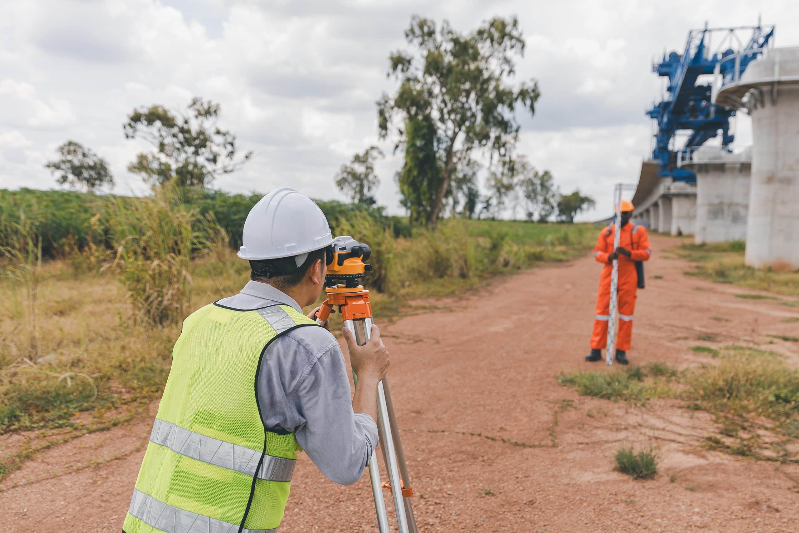
Field investigation comes next. We conduct a physical site inspection to verify the information from records. We note visible utility markers like manhole covers, valve boxes, and utility poles. But the real work happens with detection technology.
Electromagnetic locators find buried metallic pipes and cables by picking up their signals. Ground Penetrating Radar (GPR) detects non-metallic utilities like PVC pipes and fiber optic lines that electromagnetic methods miss. For the most accurate results, we use both technologies together.
We record the location, depth, size, type, and condition of each utility we identify. We use GPS and surveying tools to map utility locations with precision. Color-coded markings on the ground indicate different utility types—red for electric, yellow for gas, blue for water, orange for telecommunications.
All this data gets compiled into a comprehensive utility survey report. The report includes photographs, maps, and detailed descriptions of each utility. It also provides recommendations for construction practices that avoid damage during excavation. You receive documentation that meets Florida standards and satisfies county requirements, lender specifications, or title company needs.
Survey Documentation You'll Receive and Why It Matters
Florida property development requires specific documentation to prove compliance with state and local regulations. Your utility survey report serves as official record of underground infrastructure on your property.
The documentation you receive should include a scaled map showing the precise location of all identified utilities. Depth measurements matter because you need to know how far down lines are buried. The report identifies utility ownership—whether lines belong to Florida Power & Light, the county water system, or private infrastructure.
Easement information is critical. Your survey documentation shows utility easements that grant companies legal access to portions of your property for installation and maintenance. These easements affect how you can use your land. You can’t build permanent structures over utility easements, and you must allow reasonable access for utility work.
For ALTA surveys required in commercial real estate transactions, the 2021 standards mandate both public and private utility documentation. Public utilities marked by 811 One Call aren’t enough anymore. You need a private utility locating company to scan and document all utilities on private property portions. This ensures comprehensive coverage that meets lender and title company requirements.
Martin County, FL building permits may require utility survey documentation during plan review. The county’s 10-21 day initial review cycle examines whether your proposed development conflicts with existing utilities. Having proper documentation upfront prevents review delays and correction cycles.
Keep your survey documentation with your property records. It protects you if disputes arise about utility locations or easement access. It’s also valuable for future development, renovations, or property sales. Buyers and their lenders will want to see current utility information.
The survey report should be clear enough that you can understand it without a surveying degree. Look for reports that use plain language explanations alongside technical data. Photos and visual maps help you see exactly where utilities run in relation to your property boundaries and planned improvements.
Property Easement Laws Affecting Utility Placement in Florida
Florida property easement laws determine who can access your land and for what purposes. Utility easements are among the most common types you’ll encounter during property development.
An easement grants someone else the right to use a portion of your property for a specific purpose. You still own the land, but the easement holder has legal rights to access and use it. Utility companies hold easements to install, maintain, and repair their infrastructure.
Florida Statutes Chapter 704 governs easements, including those created by necessity and statutory rights. Understanding these laws helps you know what restrictions apply to your property and what utility companies can legally do on your land.

Types of Utility Easements on Florida Properties
Express easements are created through written agreements recorded in public records. When a property is subdivided or developed, the developer typically grants utility easements to service providers. These recorded documents specify the easement location, width, and permitted uses.
Easements by necessity arise under Florida law when a property is landlocked or lacks access to essential services. If your property needs utility connections and the only practical route crosses neighboring land, an easement by necessity may be established. Florida Statutes Section 704.01 recognizes these easements for utility services including water, wastewater, natural gas, electricity, and telephone service.
Prescriptive easements develop through long-term use. If a utility company has openly and continuously used a portion of your property for 20 years without permission, they may establish a prescriptive easement under Florida common law. Unlike adverse possession, this doesn’t transfer ownership—just the right to continue the specific use.
Conservation easements under Florida Statutes Section 704.06 can restrict utility placement to protect environmental resources. If your property has a conservation easement, you may face limitations on where utilities can be installed or what types of development are permitted.
The type of easement matters because it determines what you can and cannot do with that portion of your property. Express easements spell out specific restrictions. Easements by necessity may terminate if alternative access becomes available. Understanding which type affects your land helps you plan development that complies with legal requirements.
Utility easements typically prohibit you from building permanent structures over them. You can landscape the area, but you must maintain access for utility companies. Blocking access or interfering with utility operations violates the easement and creates legal liability.
How Easement Laws Impact Your Development Plans
Property easement laws directly affect where you can build and what improvements you can make. Before you finalize development plans, you need to know what easement restrictions apply to your Martin County, FL property.
Setback requirements in Martin County’s Land Development Regulations work together with easement restrictions. You might have a 25-foot setback from your property line, but if there’s also a 20-foot utility easement, you’re looking at 45 feet of restricted space. Your buildable area shrinks when easements overlap with setback zones.
Utility companies have the legal right to enter easement areas for maintenance and repairs. They don’t need your permission each time. If a water line breaks in your utility easement, the county can dig up that portion of your property to fix it. You can’t refuse access, and they’re not required to restore landscaping beyond basic grading.
Development plans that ignore easements face rejection during Martin County’s permitting process. The county reviews proposed improvements against recorded easements. If your building footprint encroaches on a utility easement, you’ll receive correction comments requiring plan revisions. This delays your project and may force design changes that increase costs.
Easement violations create legal problems. If you build over a utility easement and later need utility work, you may be required to remove your improvements at your own expense. The utility company’s easement rights supersede your property improvements.
Florida courts enforce easement rights strictly. Disputes over easement access, scope, or maintenance responsibilities often require legal resolution. Property owners who interfere with easement holders’ lawful rights face potential lawsuits and liability for damages.
Smart development planning incorporates easement restrictions from the start. Your utility survey identifies where easements exist and what limitations they impose. You can then design around these restrictions rather than discovering conflicts after you’ve invested in plans that won’t work.
Some easements allow limited improvements with utility company approval. If you want to pave a driveway over a utility easement, you might get permission if you use materials that allow easy access to underground lines. Always get written approval before making improvements in easement areas.
Getting Your Florida Property Development Started Right
Utility surveys and easement documentation aren’t just regulatory boxes to check. They’re practical tools that protect your investment and keep your Martin County, FL development project moving forward. Knowing what’s underground and what restrictions apply to your property lets you plan accurately, budget realistically, and avoid the costly surprises that derail projects.
The technology available today makes utility surveys faster and more accurate than ever. GPS, 3D laser scanning, and drone aerial mapping deliver comprehensive data in days rather than weeks. We understand Florida regulations and Martin County requirements, ensuring your documentation meets the standards lenders, title companies, and building departments expect.
Start with a clear understanding of what you need. If you’re planning property development in Martin County, FL, we provide the utility survey services and easement documentation that give you confidence in your project from day one.