Summary:
You’re ready to build that fence. Or close on a property. Or settle once and for all where your land ends and your neighbor’s begins. But first, you need to know what a boundary survey actually costs—and whether it’s worth it.
The short answer? In Florida, you’re looking at anywhere from $400 to $3,000 for most residential properties. The longer answer involves your lot size, terrain, how complicated your property records are, and what you’re actually trying to accomplish. Let’s break down what drives those numbers and what you’re really paying for.
What Is a Boundary Survey and Why Does It Matter?
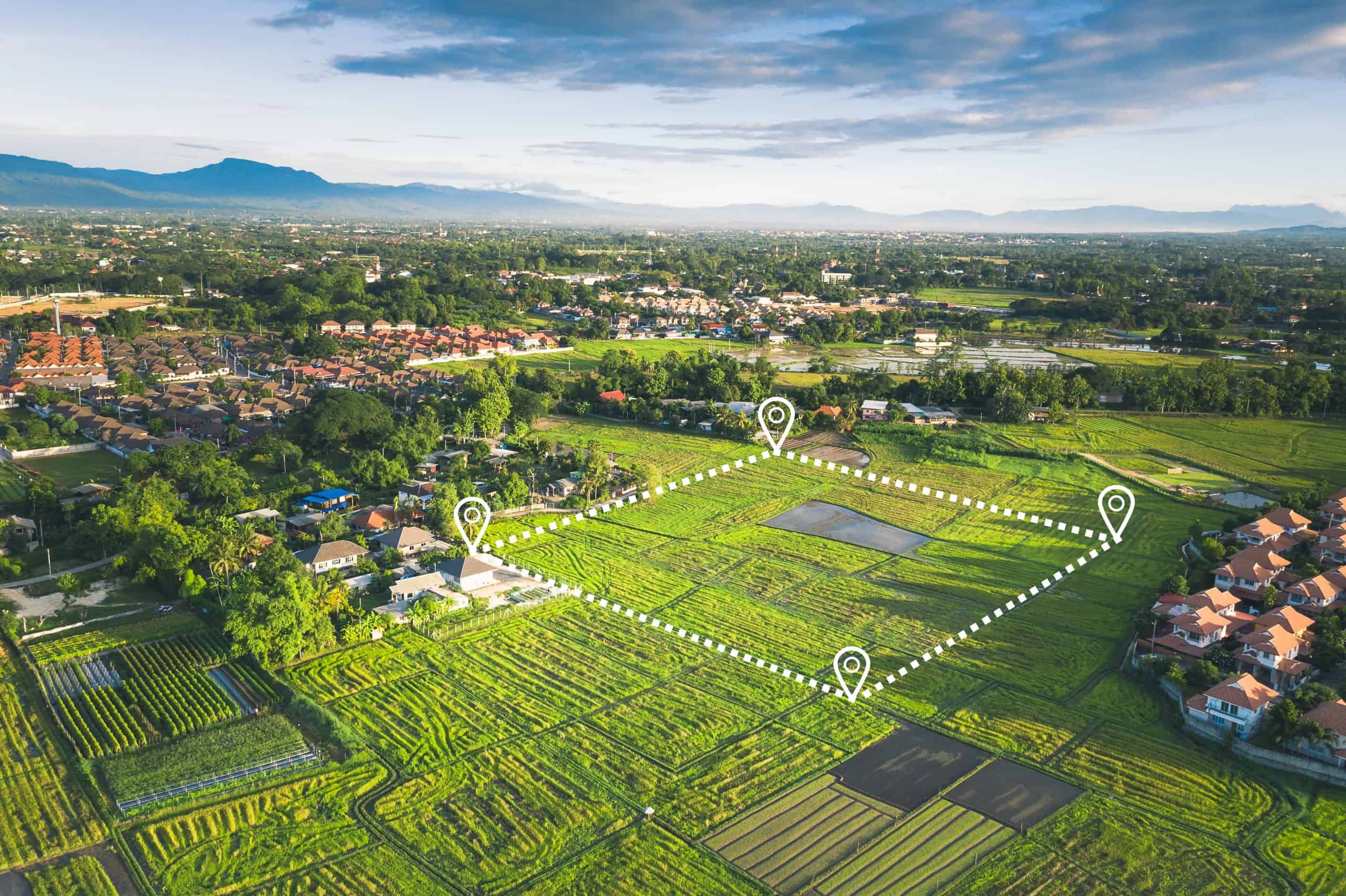
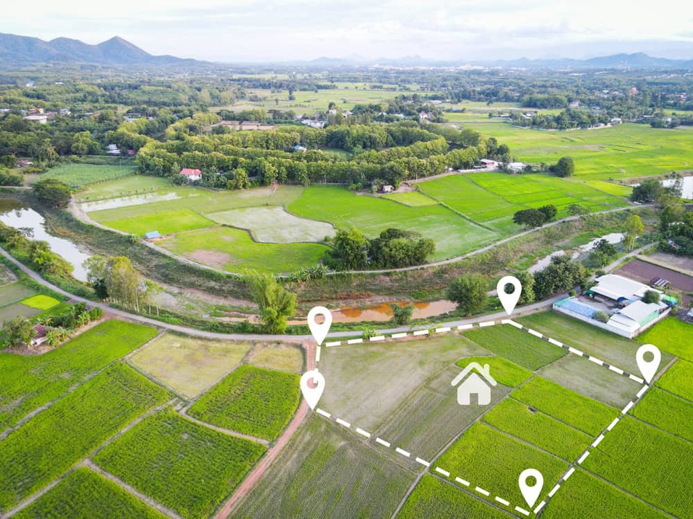
A boundary survey isn’t a guess or an estimate. It’s a licensed surveyor physically locating your property corners, measuring distances and angles, researching deed records, and creating a detailed map that shows exactly where your land begins and ends.
You get a legal document with the surveyor’s seal that holds up in court, shows encroachments, identifies easements, and gives you the confidence to build, sell, or settle disputes without second-guessing. It’s not just lines on paper—it’s proof of what you own.
Most people don’t think about surveys until they need one. Then they realize that assumptions about property lines—based on old fences or where they’ve been mowing—don’t mean much when a neighbor hires their own surveyor or the county asks for documentation.
Cost to Have Your Property Surveyed in Florida
If you’re trying to figure out what you’ll actually pay to have your property surveyed in Florida, the range is wide but predictable once you know what matters. A standard residential boundary survey for a typical quarter-acre lot runs between $500 and $800. Half-acre properties usually fall in the $600 to $1,200 range. Once you’re looking at a full acre or more, expect $800 to $1,800 or higher.
Those are baseline numbers for straightforward properties with clear records and normal terrain. Add complications—dense vegetation, missing property markers, unclear deed descriptions, or difficult access—and costs go up. If your property sits in a swampy area or has heavy brush along the property lines, surveyors need extra time to clear sight lines and locate boundaries. That can add 20% to 40% to the final bill.
Location within Florida also plays a role. South Florida counties like Miami-Dade and Broward tend to run 15% to 25% higher than North or Central Florida due to higher operating costs and demand. Martin County falls somewhere in the middle, with competitive pricing that reflects both the coastal market and the mix of residential and rural properties.
The type of survey you’re ordering matters too. A simple boundary survey that establishes property lines costs less than a comprehensive ALTA survey that includes title research, easement identification, and detailed Table A items. Most homeowners don’t need an ALTA survey unless they’re dealing with commercial property or a lender requires it. For fences, additions, or real estate transactions, a standard boundary survey does the job.
Turnaround time affects cost as well. Standard delivery is usually 5 to 7 business days. If you need results in 24 to 48 hours, expect to pay a rush fee that adds 15% to 30% to the standard price. Planning ahead saves money.
One often-overlooked factor is the availability of property records. If the county has clear, well-maintained records with recent surveys on file, your surveyor can work faster. Missing or unclear records mean more research time, which translates to higher costs. Properties with old Spanish land grants or metes and bounds descriptions from the 1800s require extra work to locate original monuments and reconcile historical data.
Average Cost to Have Property Surveyed: What's Included
When you pay for a boundary survey, you’re not just paying for someone to walk your property with a measuring tape. You’re paying for research, fieldwork, analysis, and a legally defensible document that protects your investment.
The process starts with research. Your surveyor digs into deed records, plat maps, and historical surveys to understand your property’s legal description and how it relates to neighboring parcels. They’re looking for original survey monuments, easements, right-of-ways, and any conveyances that might have changed the property over time. This research happens before anyone sets foot on your land.
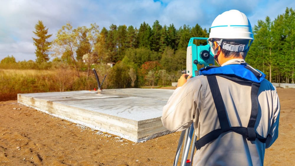
Next comes the fieldwork. Licensed surveyors visit your property to locate existing monuments, measure boundaries, and set new corner markers if needed. They use GPS equipment, total stations, and sometimes drones to capture accurate measurements. If your property has dense vegetation, they clear brush to establish sight lines. If original markers are missing—common on older properties—they reconstruct their position from other evidence, which adds time and cost.
After fieldwork, the surveyor creates a detailed plat showing your property’s dimensions, the location of structures relative to boundary lines, any easements or encroachments, and setback distances. The plat includes the surveyor’s seal and signature, the date of the survey, a north arrow, the scale of the drawing, and references to the deed and plat records used. You also get a written legal description that matches your deed.
What you’re really paying for is precision and legal protection. A survey completed by a Florida-licensed Professional Surveyor and Mapper (PSM) carries weight in court. If a dispute arises, that document is your evidence. If you’re building and need a permit, that document proves compliance with setback requirements. If you’re buying or selling, that document confirms exactly what’s being transferred.
The average cost to have a property surveyed reflects all of this work. It’s not inflated—it’s the price of doing it right. Discount surveyors who cut corners on research or fieldwork might save you money upfront, but they can cost you thousands if their work doesn’t hold up when it matters.
Boundary Survey Cost Factors That Change Your Price
Not all properties cost the same to survey, and understanding what drives those differences helps you budget accurately. The biggest factor is property size. Larger properties take more time to survey because there are more boundary lines to measure, more corners to locate, and more area to cover. Most surveyors price per acre or per lot, with per-acre rates typically ranging from $50 to $200 for additional acreage beyond a base fee.
Terrain and vegetation come next. A flat, clear lot surveys much faster than a wooded or swampy parcel. In Florida, wetlands and heavily wooded lots are common challenges. If a crew needs to clear brush to establish sight lines, expect costs to increase. Steep grades, dense mangroves, or mature landscaping all slow down the process and add labor hours.
The shape and complexity of your property matter too. A rectangular lot with four corners is straightforward. An irregular lot with eight or twelve corners requires more measurements, more calculations, and more time. Each corner needs to be located, verified, and potentially marked with a new monument.
Easement Survey Cost and What It Covers
Easement surveys serve a different purpose than standard boundary surveys, though they often overlap. An easement survey identifies and documents easements on your property—areas where someone else has legal rights to use your land for a specific purpose. Common examples include utility easements for power lines, drainage easements for stormwater management, or access easements for shared driveways.
The cost of an easement survey depends on how many easements exist, how complex they are, and whether they’re already recorded. If you’re dealing with a simple utility easement that’s clearly documented in county records, the surveyor can often include it as part of a standard boundary survey without significant additional cost. If you’re trying to identify unrecorded easements, resolve conflicts between recorded easements and actual use, or create a new easement, the work becomes more involved and expensive.
Easement surveys typically cost between $500 and $1,500 for residential properties, with the price climbing for commercial properties or complicated situations. The surveyor researches recorded easements, locates them on the ground, measures their dimensions, and documents their relationship to property boundaries and improvements. If you’re building and need to confirm that your structure won’t violate an easement, this documentation is critical.
One scenario where easement surveys become essential is when you’re buying property and discover that utility companies have underground infrastructure running through it. You need to know where those easements are before you build a pool, install a septic system, or plan landscaping. Building over an easement can force you to remove improvements at your own expense if the easement holder needs access.
Another common situation involves shared driveways or access roads. If your property includes an easement that allows a neighbor to cross your land to reach theirs, you need documentation showing exactly where that easement runs and what restrictions it places on your use of the property. Without a survey, disputes arise when one party wants to modify the driveway or limit access.
Creating a new easement also requires a survey. If you’re subdividing land and need to create access easements for new parcels, or if you’re granting a utility easement to a company installing infrastructure, the surveyor prepares a legal description and plat that gets recorded with the county. This ensures the easement is properly documented and enforceable.
Lot Line Survey Cost vs. Boundary Survey
The terms “lot line survey” and “boundary survey” are often used interchangeably, and in most cases, they refer to the same thing. Both identify the legal boundaries of a parcel by locating existing monuments, setting new ones if needed, and calculating property dimensions from the recorded legal description. Some surveyors use the terms based on regional preference or the specific purpose of the survey, but the work involved is essentially identical.
Where you might see a distinction is in the level of detail provided. A basic lot line survey focuses primarily on locating and marking property corners and boundary lines. It gives you the information you need to know where your property ends, which is enough for many purposes like installing a fence or resolving a simple boundary question with a neighbor.
A more comprehensive boundary survey includes everything in a lot line survey plus additional details like the location of improvements (buildings, driveways, fences), easements, encroachments, setback measurements, and a detailed plat drawing. This level of detail is typically required for real estate transactions, building permits, or situations where you need a complete picture of your property’s legal status.
The cost difference between a basic lot line survey and a comprehensive boundary survey is usually minimal—maybe $100 to $200—because the surveyor is already doing most of the work. Once they’re researching records and visiting the property, adding measurements for improvements and easements doesn’t take much additional time. For that reason, most surveyors recommend getting the full boundary survey even if you think you only need lot lines. It gives you documentation you can use for multiple purposes without having to order another survey later.
In Florida, the distinction matters less than in some other states because Florida’s surveying standards require licensed surveyors to find or set all corner monuments and prepare a real boundary survey even for mortgage surveys. You’re not going to get a half-baked sketch that disclaims responsibility for accuracy. If a Florida surveyor signs and seals a survey, they’re standing behind their boundary determination.
When you’re getting quotes, make sure you understand what’s included. Ask whether the surveyor will physically stake the boundary corners (place visible markers at each corner of your property) in addition to producing the plat drawing. Staked boundaries make it easier to identify future encroachments and give you visible reference points on the ground. Some surveyors include staking in their standard fee; others charge extra. Knowing upfront prevents surprises.
When a Boundary Survey Saves You Money
The best time to order a boundary survey is before you need one in a crisis. If you’re buying property, get the survey done before closing. If you’re planning a fence, pool, or addition, get it done before construction starts. If you’re noticing tension with a neighbor over property lines, get it done before lawyers get involved.
A $500 to $800 survey prevents $5,000+ mistakes. It keeps you from building a fence on your neighbor’s land and having to tear it down. It stops boundary disputes before they turn into lawsuits. It confirms that the property you’re buying is actually the size the seller claims. It proves your addition complies with setback requirements so the county doesn’t make you modify or remove it.
For Martin County property owners, working with a surveying company that understands local requirements and has modern technology makes the process smoother. We use GPS and 3D laser scanning for precision, provide dedicated project managers for clear communication, and offer a 24-48 hour callback guarantee for quote requests. Whether you’re in Martin County, Okeechobee County, or Indian River County, getting accurate boundary documentation protects your investment and gives you confidence to move forward with your plans.