Topographical Surveyors Florida

Know Your Land Before You Build

A person wearing a bright yellow vest, likely one of the Land Surveyors in Martin County, is outdoors holding a tablet displaying a topographic map. The background reveals a sunlit, grassy area with trees.
A white checkmark inside a black circle on a dark background, symbolizing accuracy and precision akin to the work of Land Surveyors in Indian River County.

Site Assessment and Planning

All surveys performed by Florida-licensed professionals with advanced GPS and 3D laser scanning technology.

Icon of a white drone with four propellers on a black circular background, ideal for assisting land surveyors in Martin County.

Dedicated Project Managers

Every job gets a dedicated manager ensuring clear communication and on-time delivery every step.

Icon depicting a hand holding three stylized people figures, symbolizing community or support. The design is in white against a black circular background, reminiscent of the unity among land surveyors in Okeechobee County.

Advanced Survey Technology

GPS precision and 3D laser scanning deliver accuracy you can build on with confidence.

Silhouette of the state of Florida in white, centered on a black circular background, representing the expertise of land surveyors from Martin County to Indian River County.

Fully Licensed and Insured

Complete licensing and insurance protection gives you peace of mind on every project.

Two land surveyors in reflective vests and hard hats work diligently on a construction site in Martin County. One uses a theodolite while the other holds a measuring pole. A crane and partially constructed building can be seen against the partly cloudy sky above.

Topographic Survey Services Florida

Detailed Land Mapping for Smart Building

Topographical surveys create detailed 3D maps showing your property’s elevations, slopes, drainage patterns, and natural features. This critical information helps you plan construction projects that work with your land instead of against it. Whether you’re building a home, planning a driveway, or designing landscaping, knowing your property’s contours prevents costly mistakes. Our surveys reveal where water flows, which areas are suitable for building, and how to design around natural features like slopes and trees.

See What Our Customers Have to Say

Professional Topographical Mapping

Build Smart, Not Sorry

Get the elevation data you need to make informed decisions about your property development and avoid expensive surprises.
A black circle with a white icon depicting a stack of papers, each with horizontal lines representing text, symbolizes the meticulous documentation and accuracy typical of land surveyors in Martin County.

You'll know exactly where water flows during storms and heavy rains.

An icon of a checklist features three items: two ticked and one crossed, mirroring the precision of land surveyors in Okeechobee County. A pencil rests on the right side against a black circular background, symbolizing accuracy and diligence.

Your construction projects will be planned around natural slopes and drainage patterns.

An icon depicting a document with a checkmark and a stamp, outlined in white on a black circular background, represents precision. Perfect for Land Surveyors in Indian River County seeking reliable documentation imagery.

You'll avoid building in areas prone to flooding or erosion issues.

Icon depicting a project document with a gear symbol, representing project planning or management, ideal for Land Surveyors in Martin County. The document features text lines and is set against a dark circular background.

Your architect and contractor get precise data for accurate project planning.

A white stopwatch icon with three motion lines on a black circular background, symbolizing the speed and efficiency of Land Surveyors in Indian River County.

You'll identify the best locations for buildings, driveways, and landscaping features.

A black circular icon with a white outline of a person raising their arms, often seen among Land Surveyors in Okeechobee County. Five stars are arranged in an arc above the person, symbolizing achievement or satisfaction.

Your project stays on schedule without costly redesigns or construction delays.

A black circle with the number 1 in it.

Share project details

Call us or get a free online quote to help us identify your project needs.

A black circle with the number 2 in it.

We'll follow up

If you requested an online quote, you can expect a callback within 24-48 hours of your request.

A black circle with the number 3 in it.

The floor is yours

Connect with an expert and share all project specifics.

A black circle with the number 4 in it.

Plan your project

Like what you hear? We'll provide next steps and expert guidance.
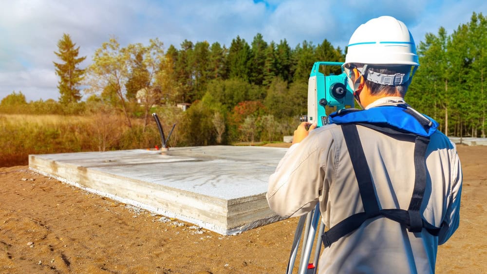
A construction worker equipped with a hard hat and safety gear uses a theodolite to survey a concrete foundation slab at a construction site. Surrounded by trees under a partly cloudy sky, this precise task is typical for Land Surveyors in Indian River County.

Elevation Survey Technology

GPS Precision You Can Build On

Our topographical surveys use advanced GPS technology and 3D laser scanning to capture precise elevation data across your entire property. This isn’t guesswork or rough estimates – it’s survey-grade accuracy that meets Florida’s professional standards. We map every contour, slope, and elevation change to create detailed terrain models. You’ll see exactly how water moves across your land, where the high and low points are, and how natural features affect your development options. This level of detail helps architects design better buildings and contractors plan more efficient construction.

Construction Planning Surveys

Everything Your Builder Needs to Know

Your topographical survey includes detailed contour maps, elevation certificates, drainage analysis, and site feature identification. We document existing structures, utilities, trees, and other important features that could affect your construction plans. The survey data comes in both digital and printed formats, making it easy for your entire project team to access and use. Architects can design around natural features, engineers can plan proper drainage, and contractors can prepare accurate bids based on real site conditions instead of assumptions.
A construction worker wearing a white hard hat and red safety vest uses a theodolite on a site. The background is blurred, highlighting his precise work with the instrument, similar to the experts from Land Surveyors Martin County who ensure accuracy and reliability in every project.
A black circle with the number 1 in it.

Site Assessment and Planning

We review your property and project needs to determine survey scope and timeline.

A black circle with the number 2 in it.

Field Survey and Data Collection

Our licensed surveyors use GPS and laser scanning to capture precise elevation data.

A black circle with the number 3 in it.

Analysis and Report Delivery

We create detailed maps and reports showing all terrain features and elevation data.