Surveying Services in Martin County, FL
Expert Aerial Land Surveys Tailored to Your Requirements
- Topographic Surveys
- Construction Layouts

See What Our Customers Have to Say

Professional Aerial Land Surveying Company in Martin County, FL
Aero Land Surveying in Martin County, FL
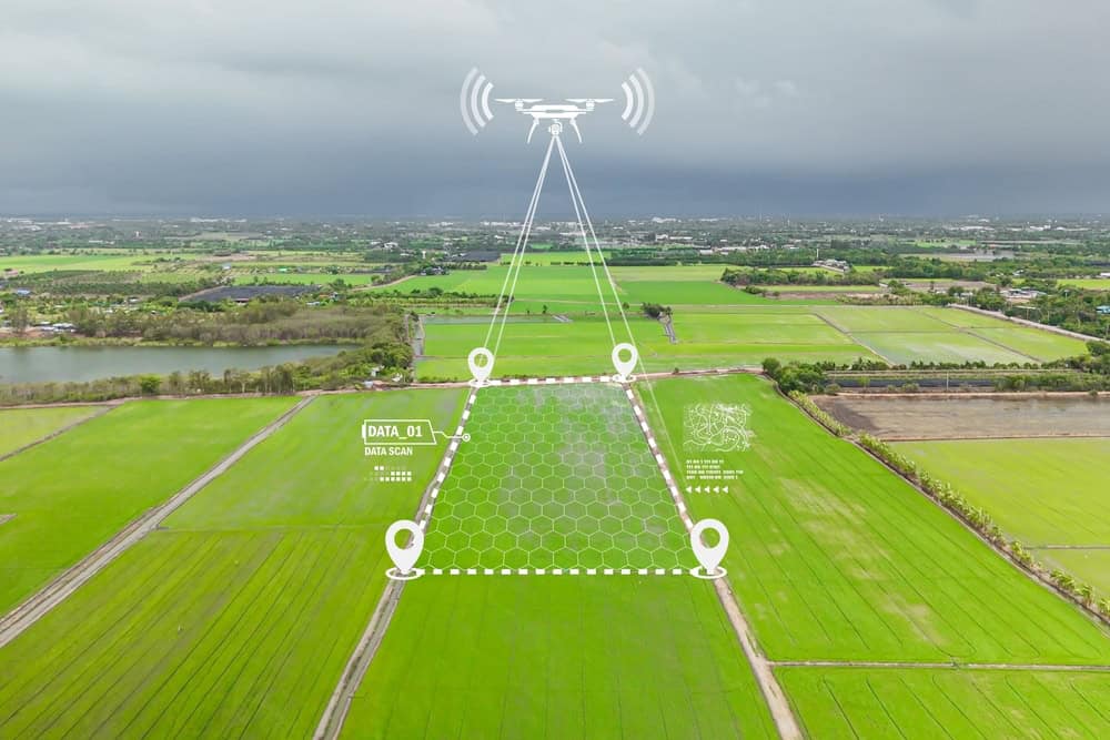
Aero Land Surveying is your go-to source for extensive aerial surveying services. We specialize in offering accurate and reliable land surveys that meet the needs of property owners, developers, and real estate professionals.
Precision-driven surveys that support confident decision-making for property owners and investors
Trusted by developers and real estate professionals for accuracy and reliability
Advanced technology and expert analysis to ensure topographic clarity and boundary definition
Scalable services for projects ranging from single lots to expansive commercial developments
Our commitment to using advanced technology and methodologies guarantees that we deliver precise land survey results every time. With over 20 years of experience in the industry, our team can handle various surveying projects, from topographic surveys to boundary determinations.
Residential and Commercial Property Surveys in Martin County, FL
Property Survey Solutions
Areas We Serve
- Brookside
- Cummings
- Fellsmere
- Florida Ridge
- Gifford
- Indian River Shores
- Nevins
- Orchid
- Oslo
- Riomar
- Roseland
- Royal Poinciana Park
- Sebastian
- South Beach
- Vero Beach
- Vero Beach South
- Wabasso
- Wabasso Beach
- West Vero Corridor
- Windsor
- Winter Beach
- Arundel
- Bessemer
- Blowing Rocks
- Bluefield
- Coral Gardens
- Gomez
- Hell Gate
- Hobe Sound
- Indiantown
- Jensen Beach
- Jupiter Island
- Marcy
- North River Shores
- Ocean Breeze
- Ocean Breeze Park
- Palm City
- Port Mayaca
- Port Salerno
- Port Sewall
- Rio
- Seminole Shores
- Snug Harbor
- Stuart
- Zana
- Barber Quarters
- Basinger
- Cypress Quarters
- Dixie Ranch Acres
- Eagle Island
- Fort Drum
- Hilolo
- Mildred
- Okeechobee
- Sherman
- Taylor Creek
- Whispering Pines
- Acacia Villas
- Atlantis
- Belle Glade
- Boca Raton
- Boynton Beach
- Briny Breezes
- Cabana Colony
- Canal Point
- Delray Beach
- Greenacres
- Gulf Stream
- Haverhill
- Highland Beach
- Hypoluxo
- Juno Beach
- Juno Ridge
- Jupiter
- Jupiter Farms
- Jupiter Inlet Colony
- Lake Belvedere Estates
- Lake Clarke Shores
- Lake Park
- Lantana
- Limestone Creek
- Loxahatchee Groves
- Mangonia Park
- North Palm Beach
- Ocean Ridge
- Pahokee
- Palm Beach
- Palm Beach Gardens
- Palm Beach Shores
- Palm Springs
- Pine Air
- Riviera Beach
- Royal Palm Beach
- Royal Palm Estates
- San Castle
- Schall Circle
- Seminole Manor
- South Bay
- South Palm Beach
- Stacey Street
- Tequesta
- The Acreage
- Watergate
- Wellington
- West Palm Beach
- Westgate
- Westlake
- Fort Pierce
- Fort Pierce North
- Fort Pierce South
- Hutchinson Island South
- Indian River Estates
- Lakewood Park
- Port St. Lucie
- River Park
- St. Lucie Village
- White City
Share project details
Call us or get a free online quote to help us identify your project needs.
We'll follow up
If you requested an online quote, you can expect a callback within 24-48 hours of your request.
The floor is yours
Connect with an expert and share all project specifics.
Plan your project
Like what you hear? We'll provide next steps and expert guidance.
